- Home
- Contact Us
- AAEES Staff
- AAEES Board of Trustees
- American Academy of Environmental Engineers Certification Board
- American Academy of Environmental Scientists Certification Board
- AAEES Committees
- State and Regional Representatives
- Representatives to Other Organizations
- Previous Leadership
- Interactive Who's Who
- Student Chapters
- Tau Chi Alpha
- News & Events
- Awards
- AAEES Awards Criteria
- 40 Under 40 Recognition Program
- Edward J.Cleary Award
- Excellence in Environmental Engineering and Science Education
- Gordon Maskew Fair Award
- Honorary Member
- International Honorary Member
- Ralph and Joe Bales Graber Science Award
- Stanley E. Kappe Award
- Environmental Communications Awards Competition
- Excellence in Environmental Engineering and Science Competition
- The AAEES Chapter Blue Marble Award
- Publications
- Join
- Members
- Program Support
- Jobs
2024 Excellence in Environmental Engineering and Science™ Awards Competition Winner
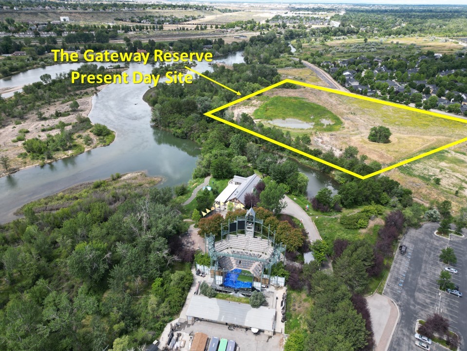
Honor Award - Small ProjectsThe Gateway ReserveEntrant: Boelter Risk Science and Engineering LLC Entrant Profile
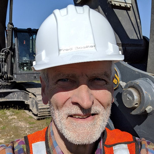
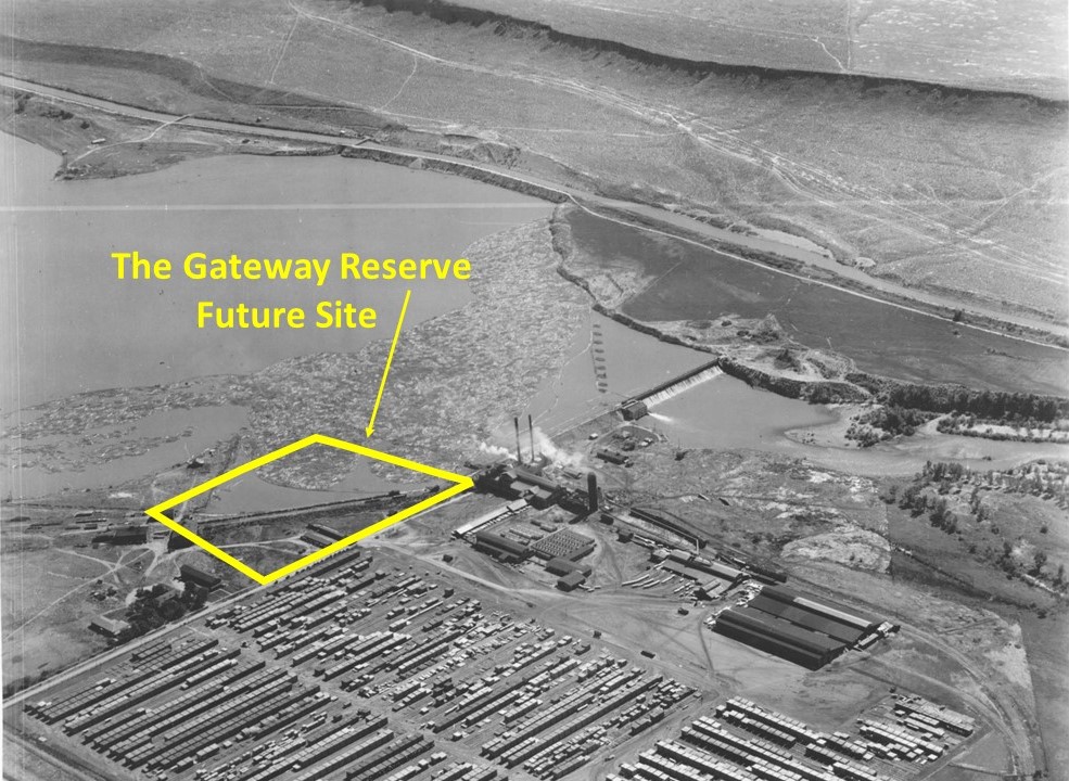
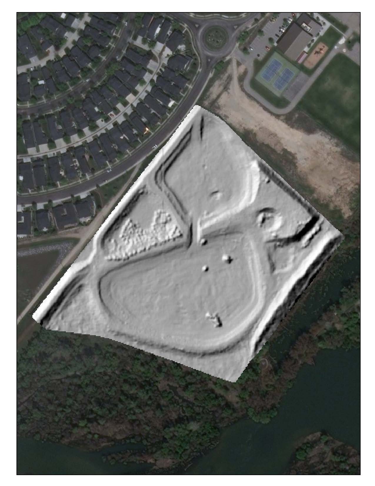
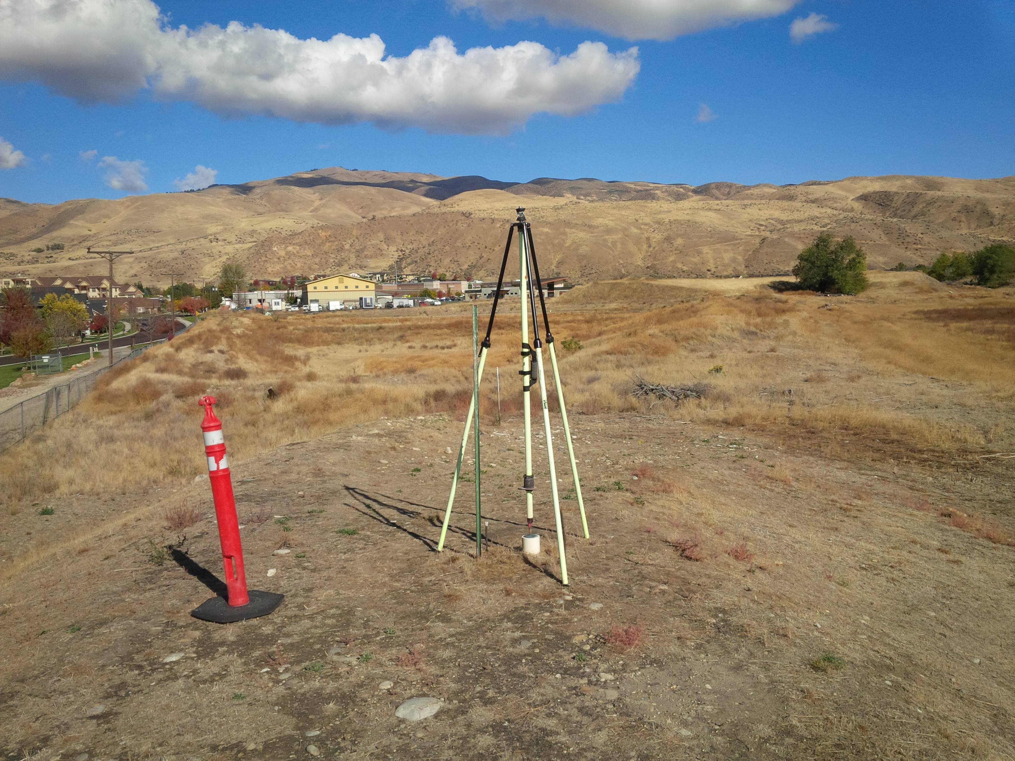
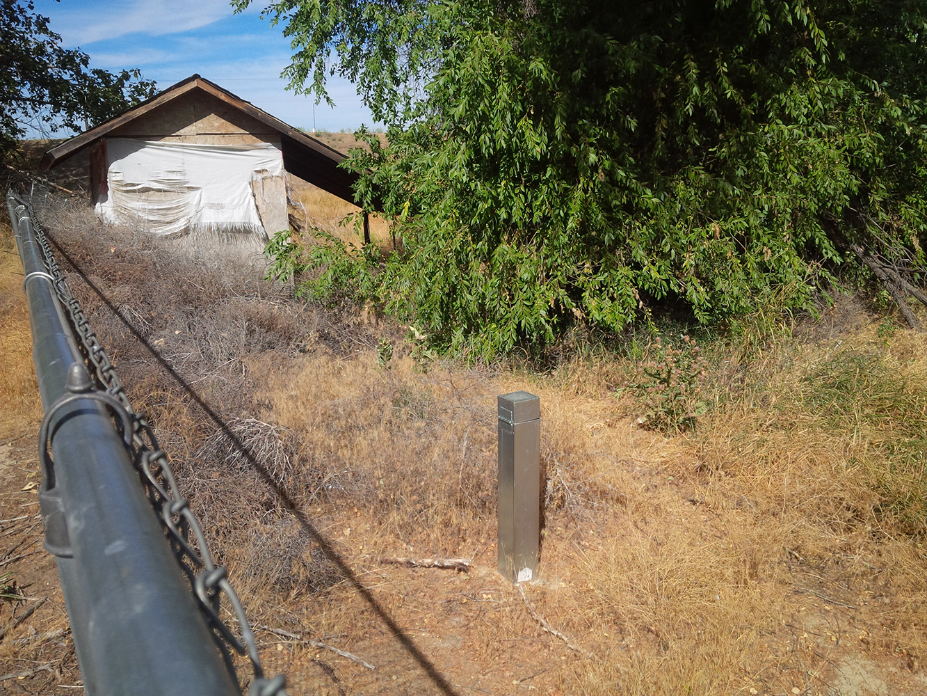
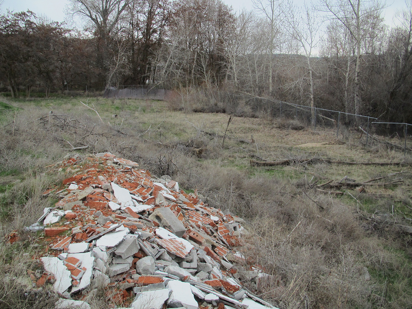
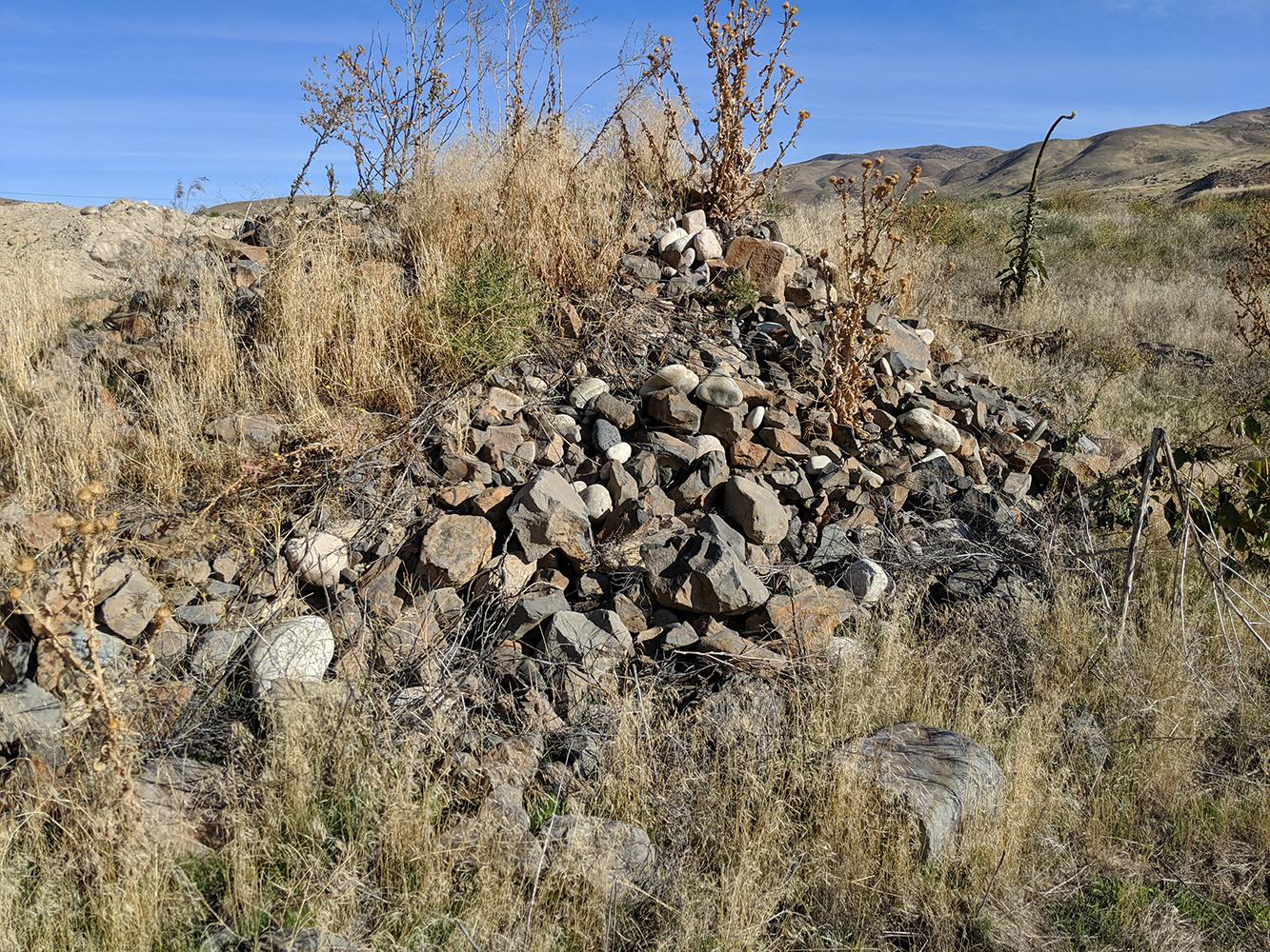
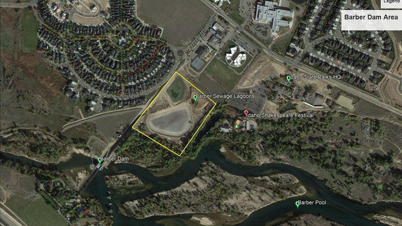
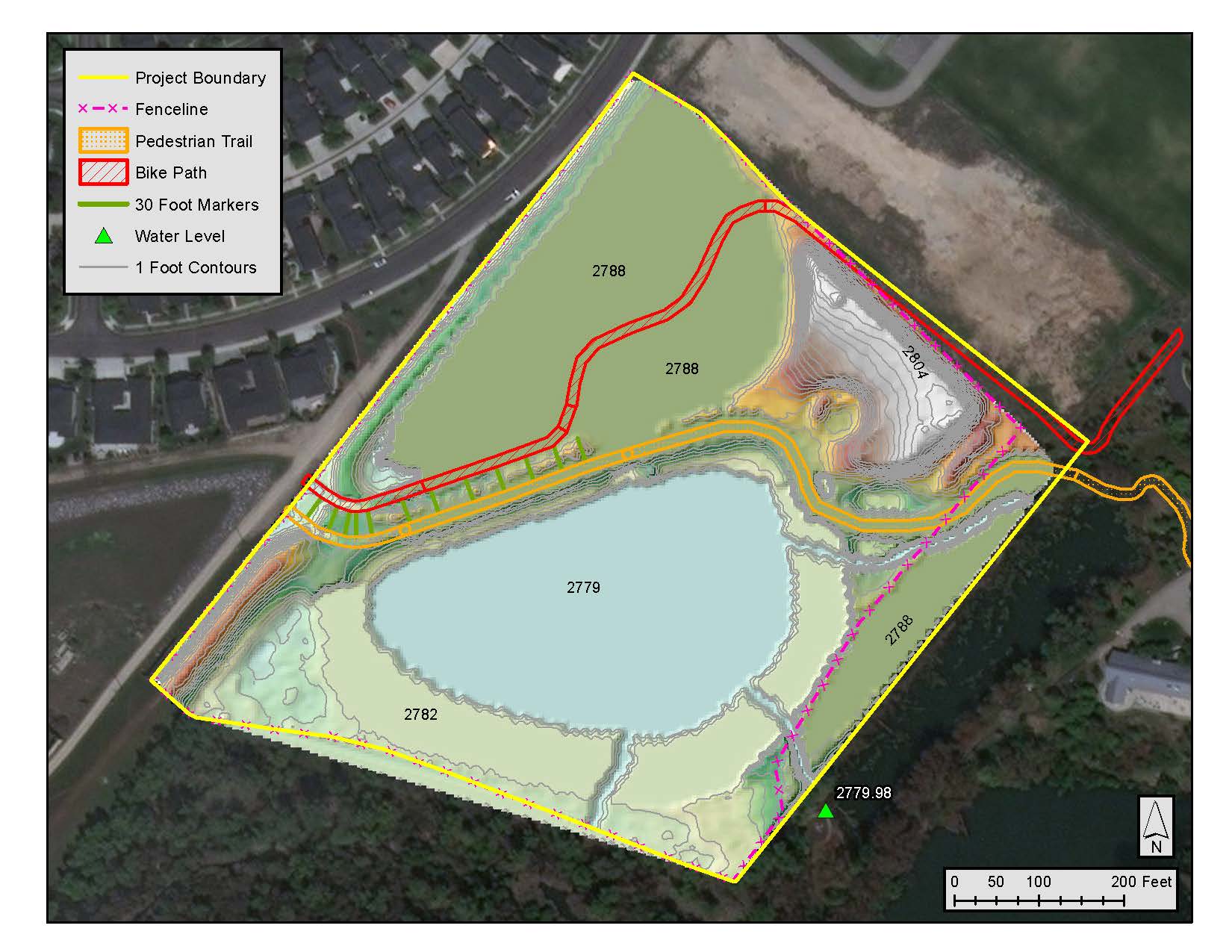
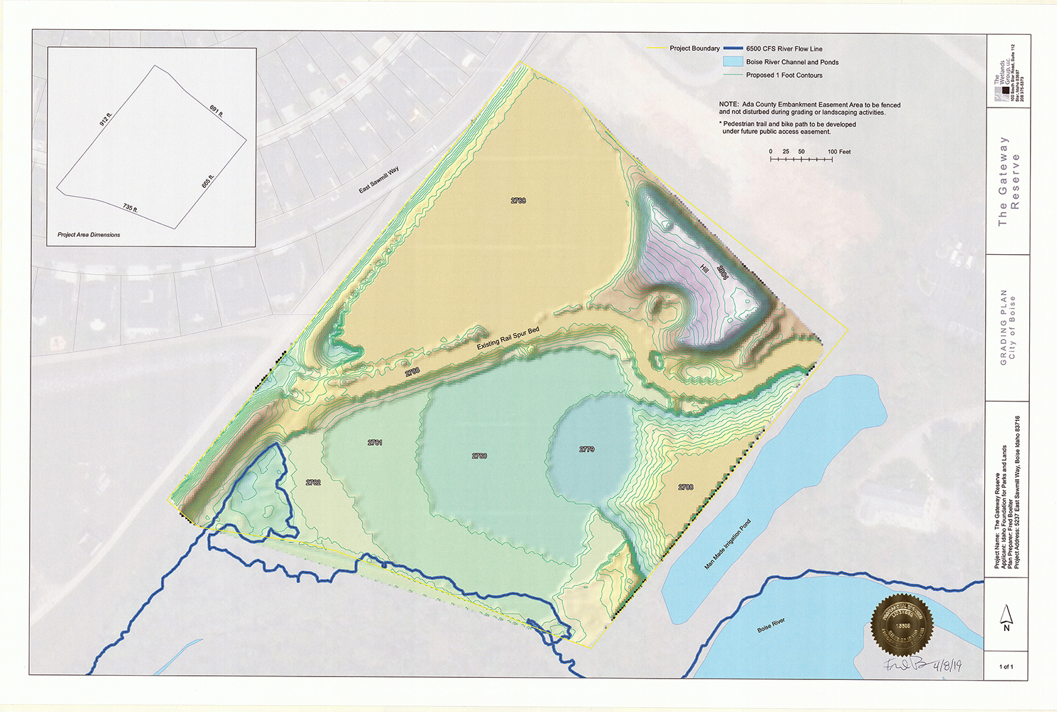
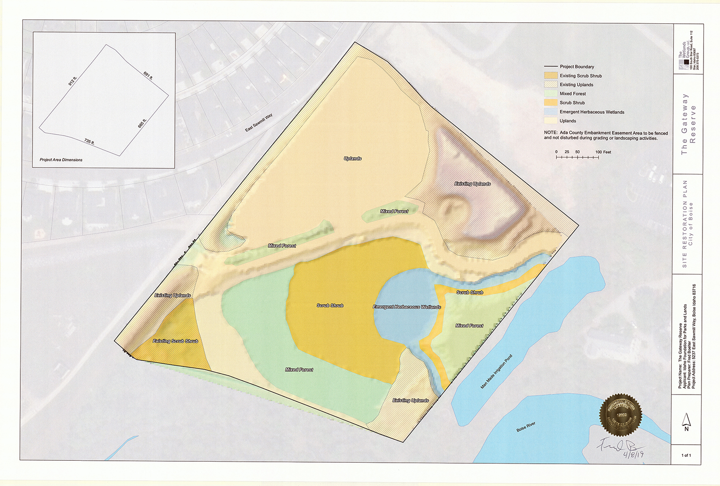
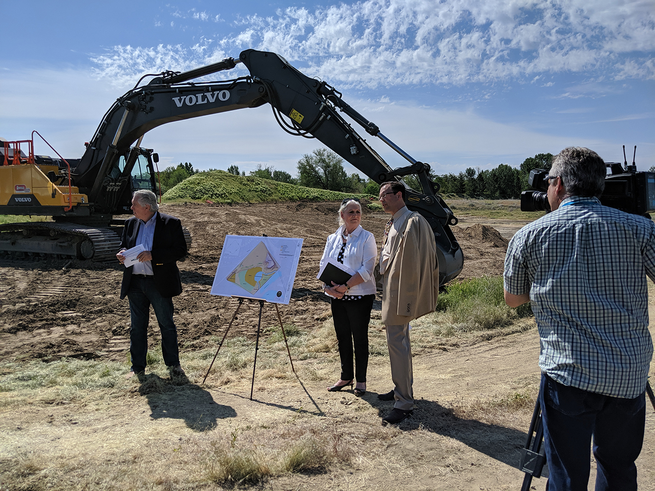
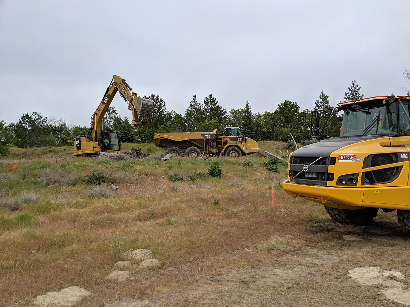
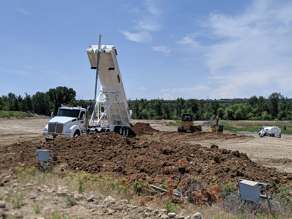
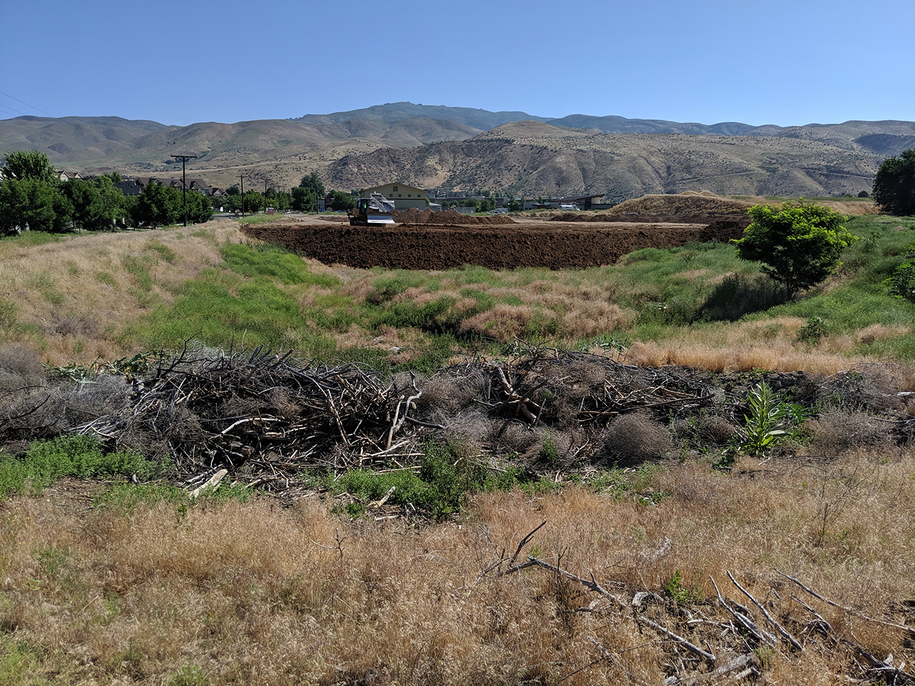
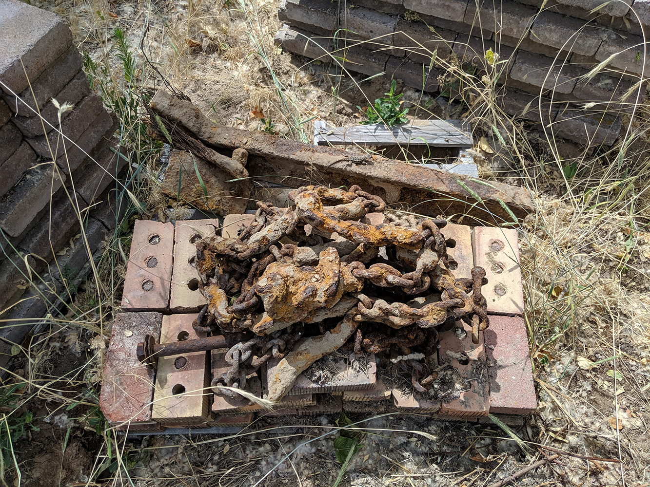
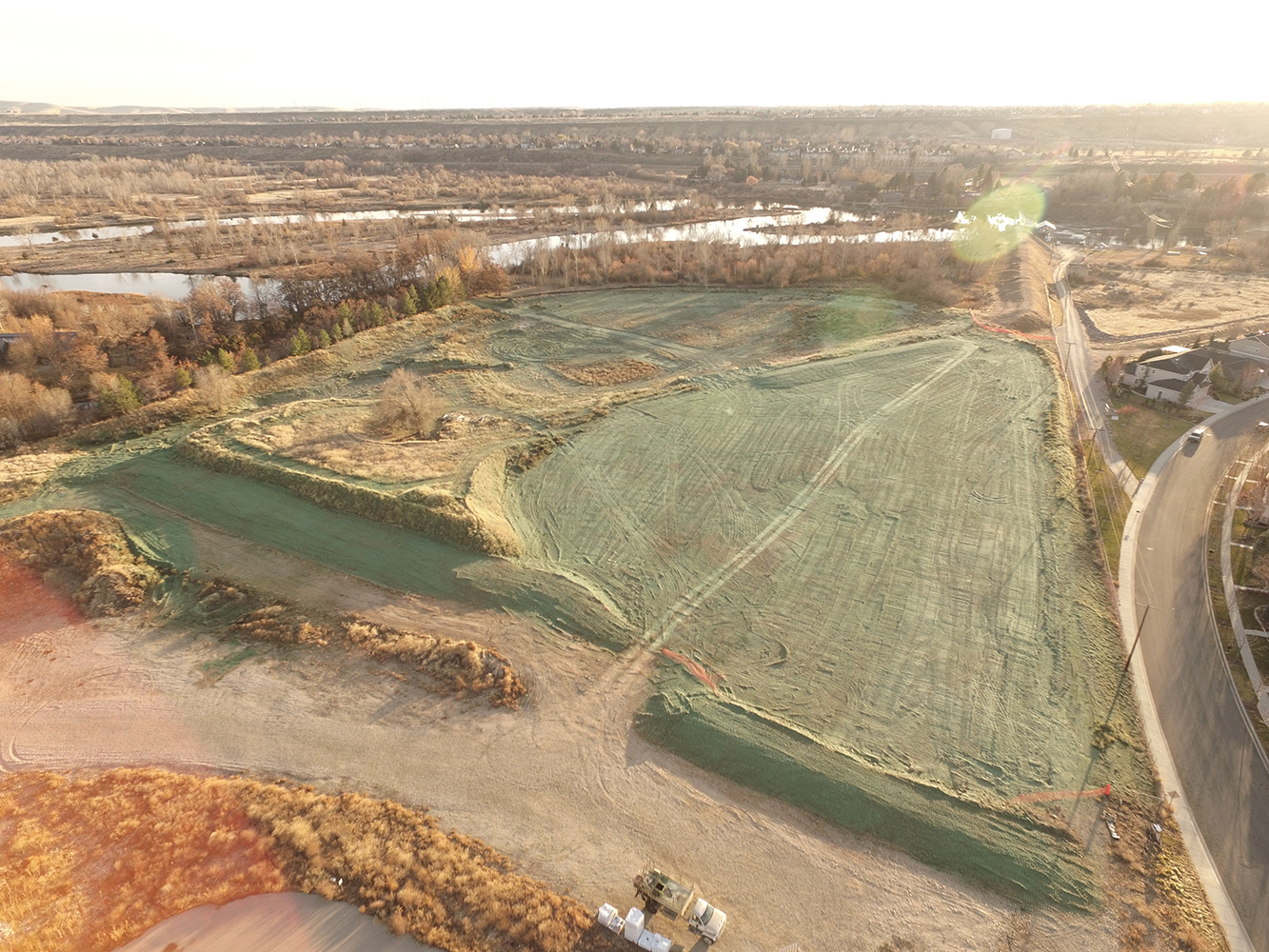
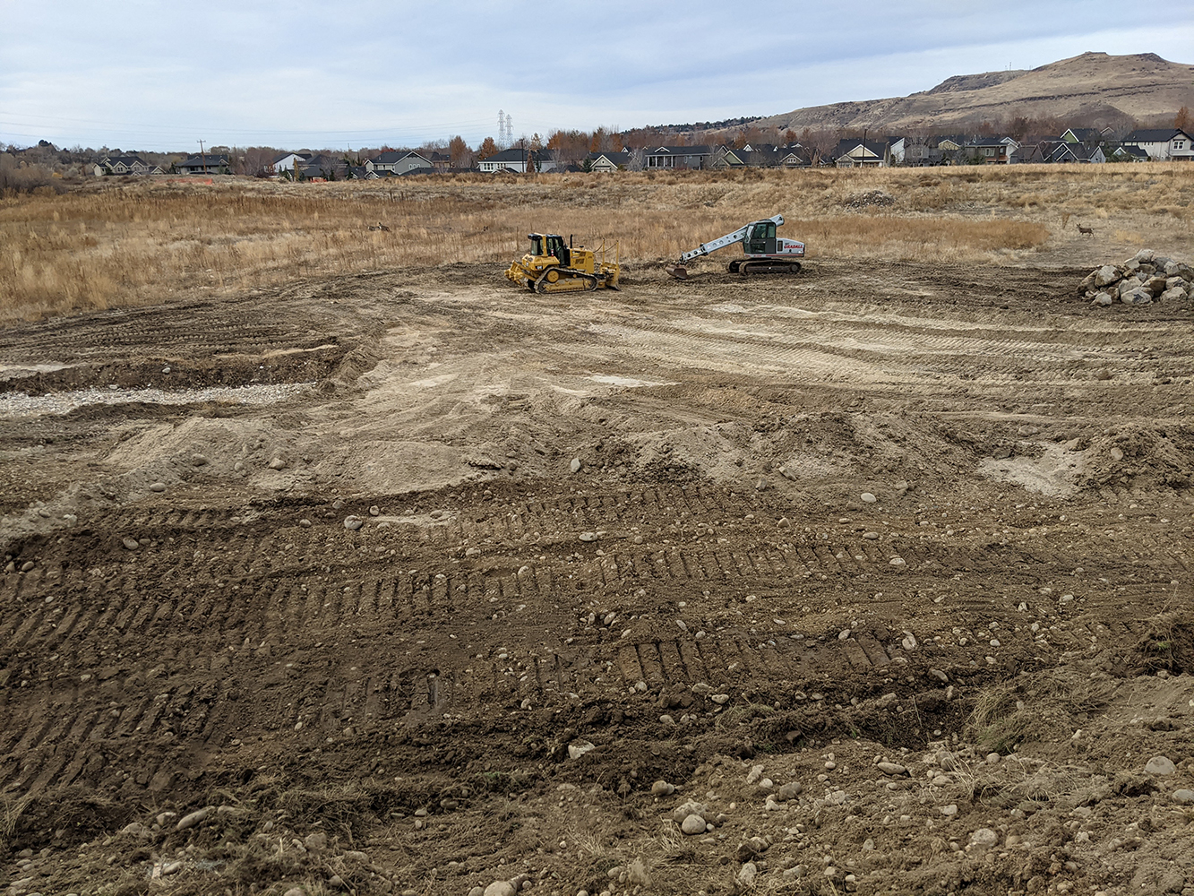
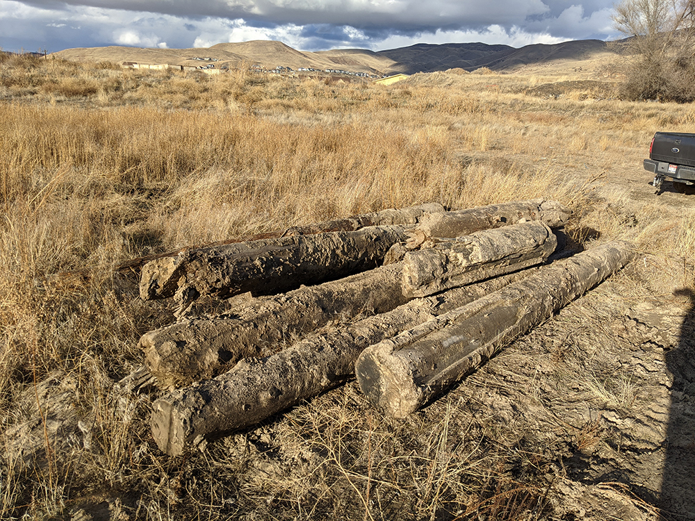
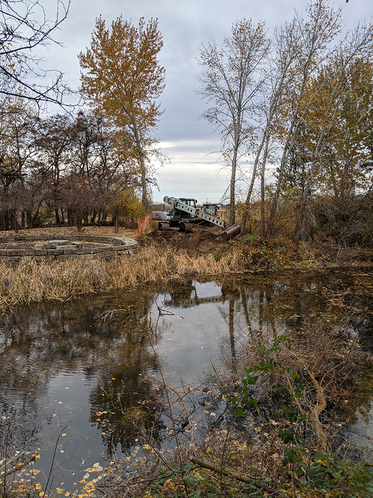
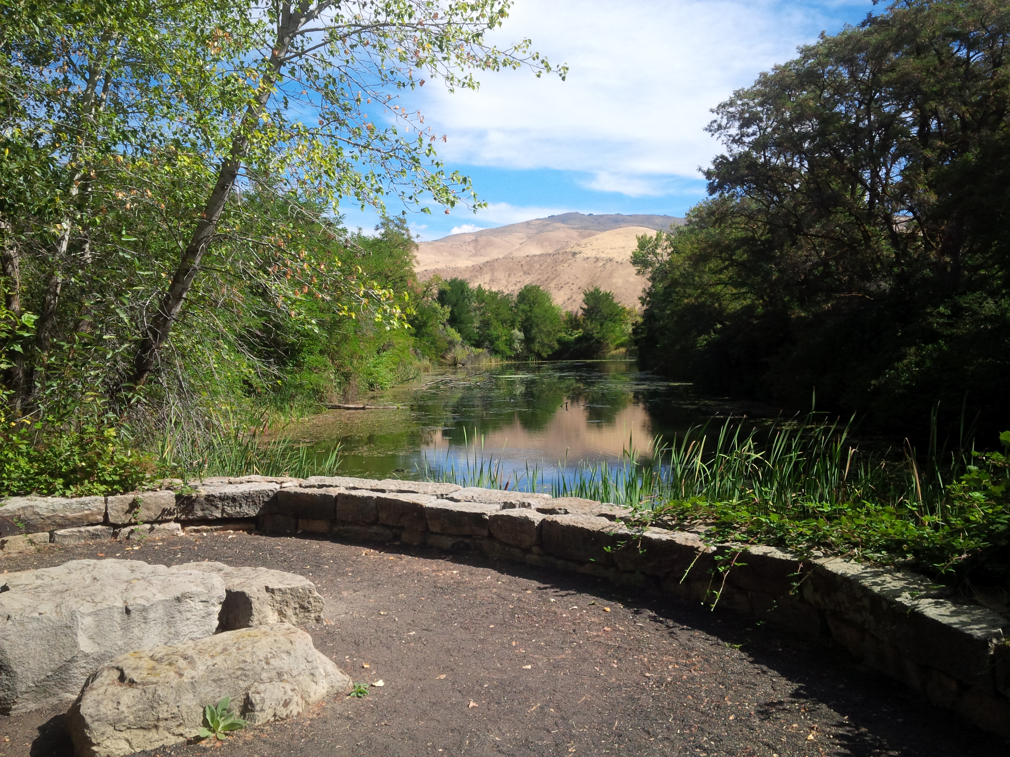
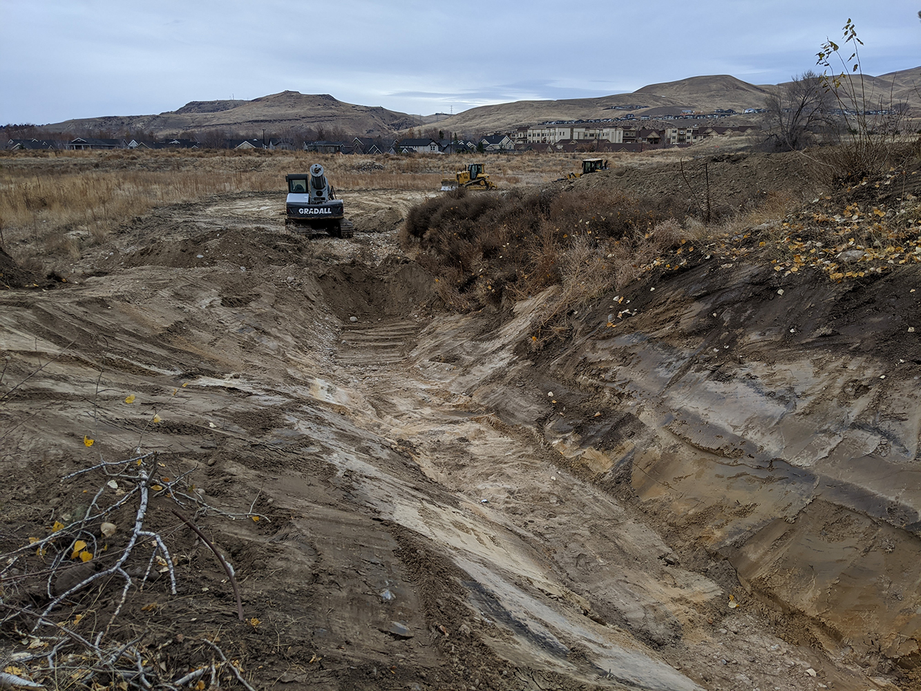
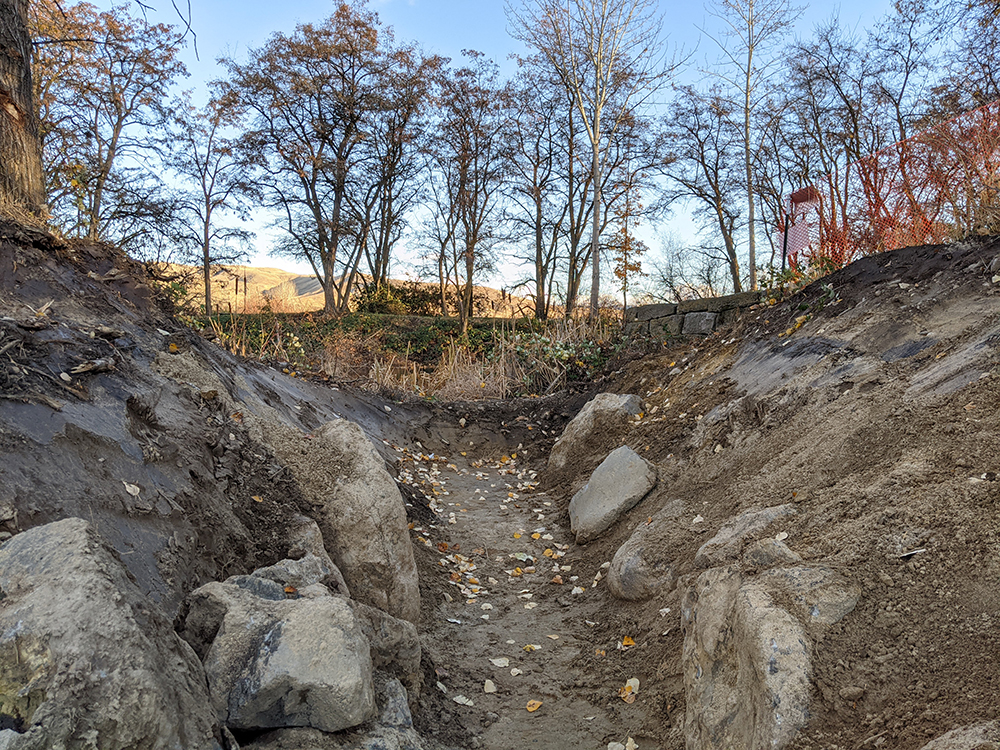
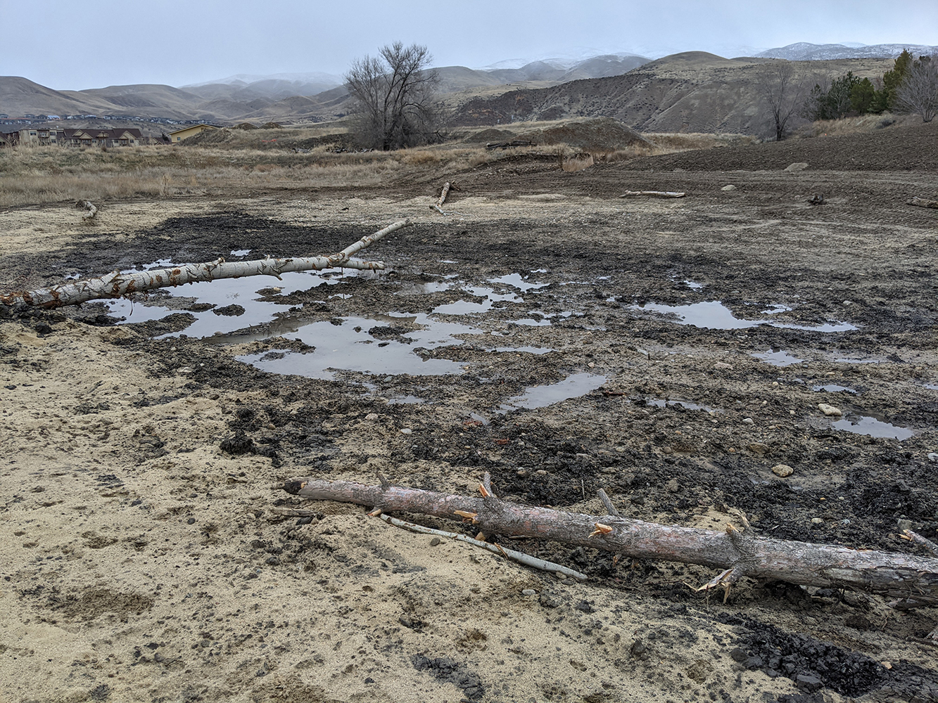
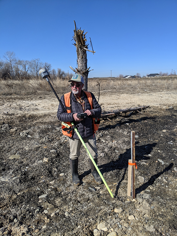
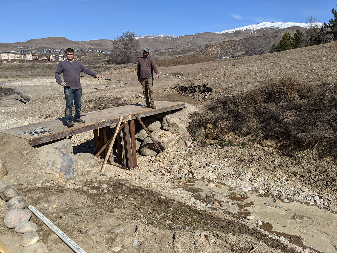
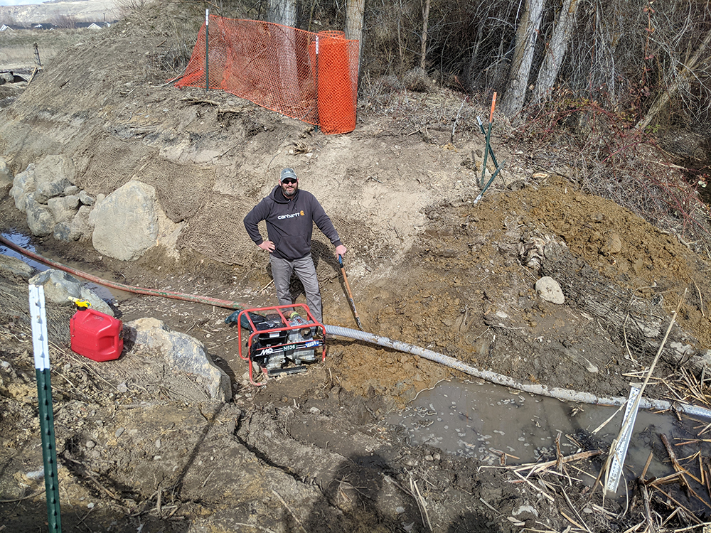
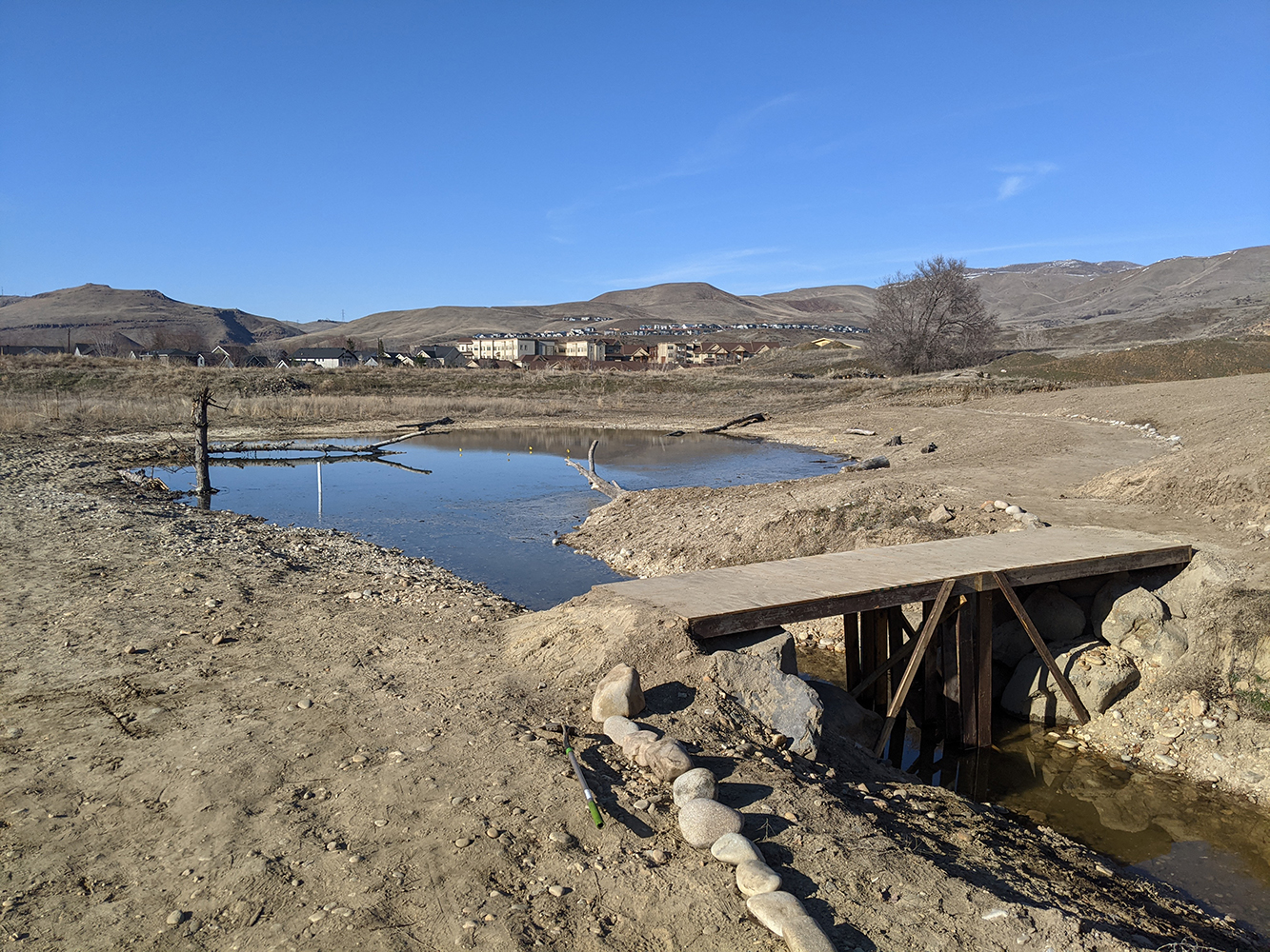
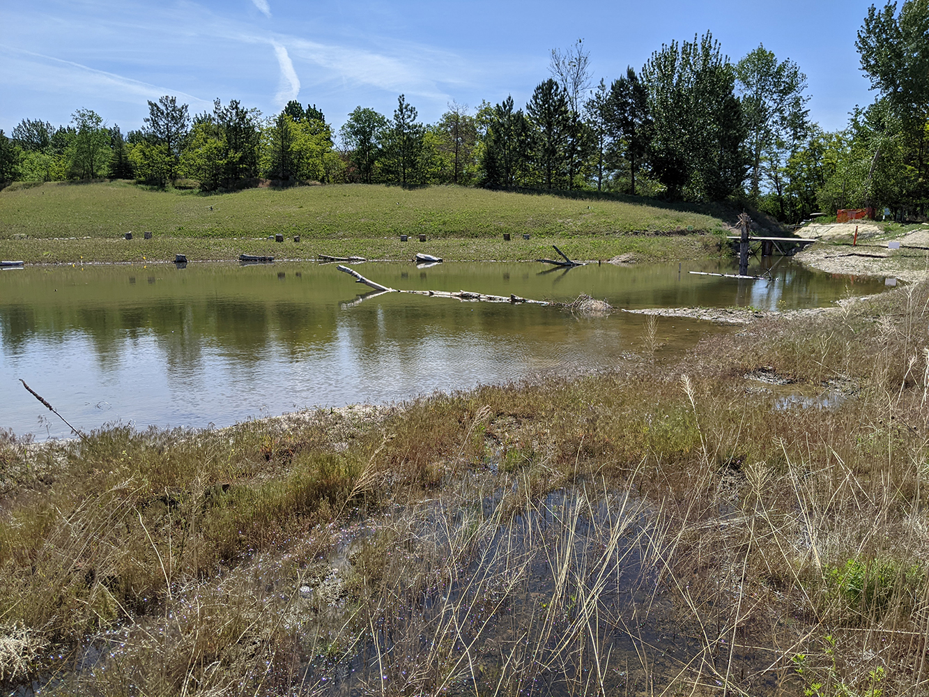
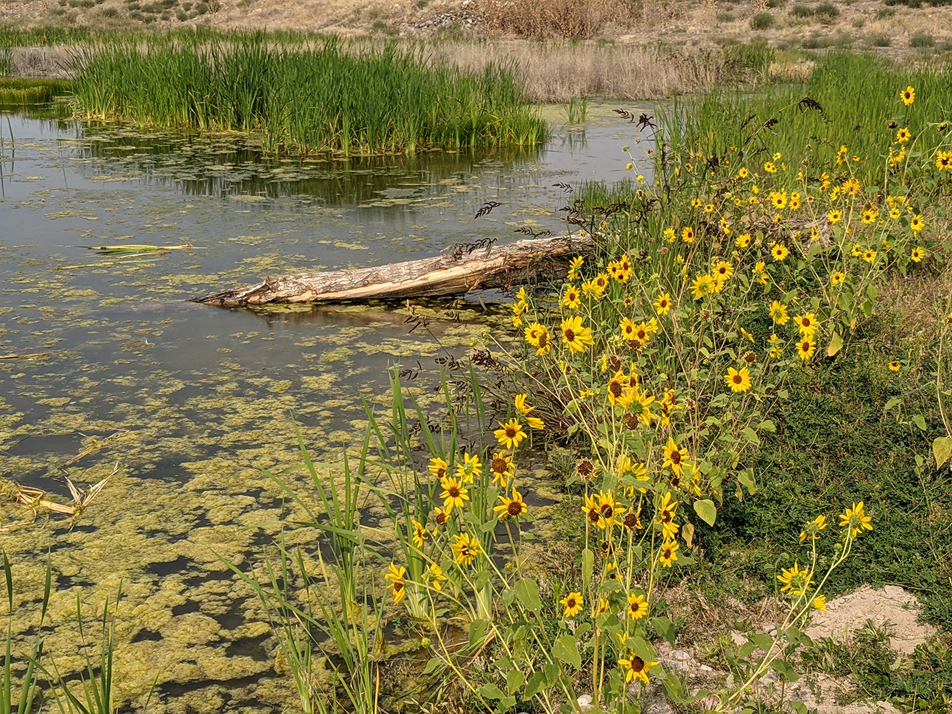
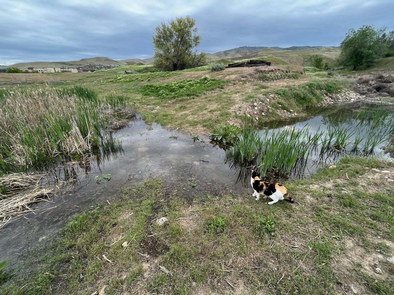
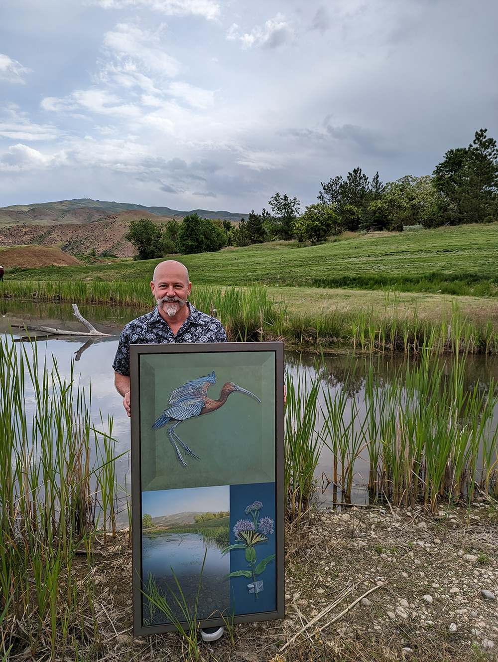
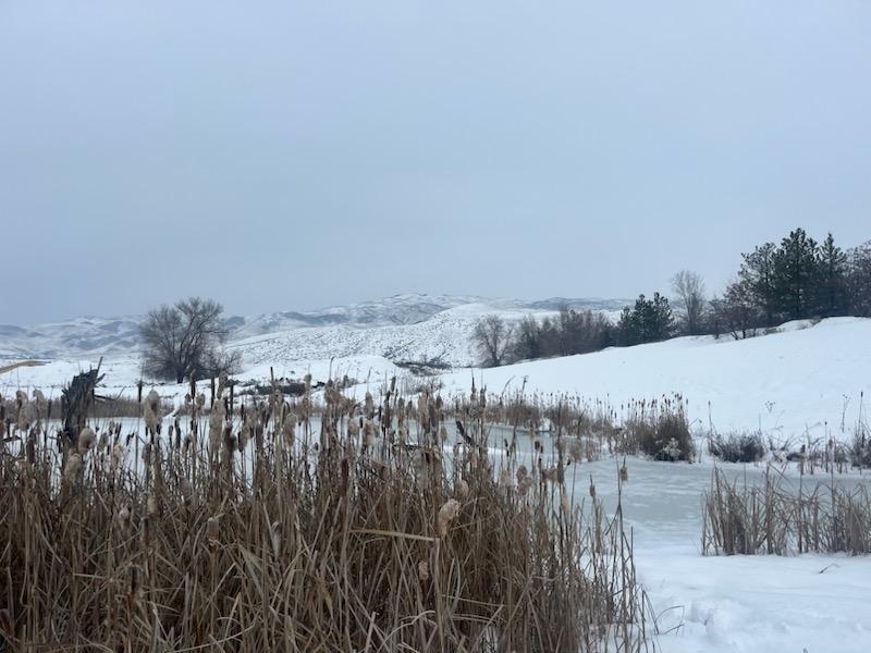
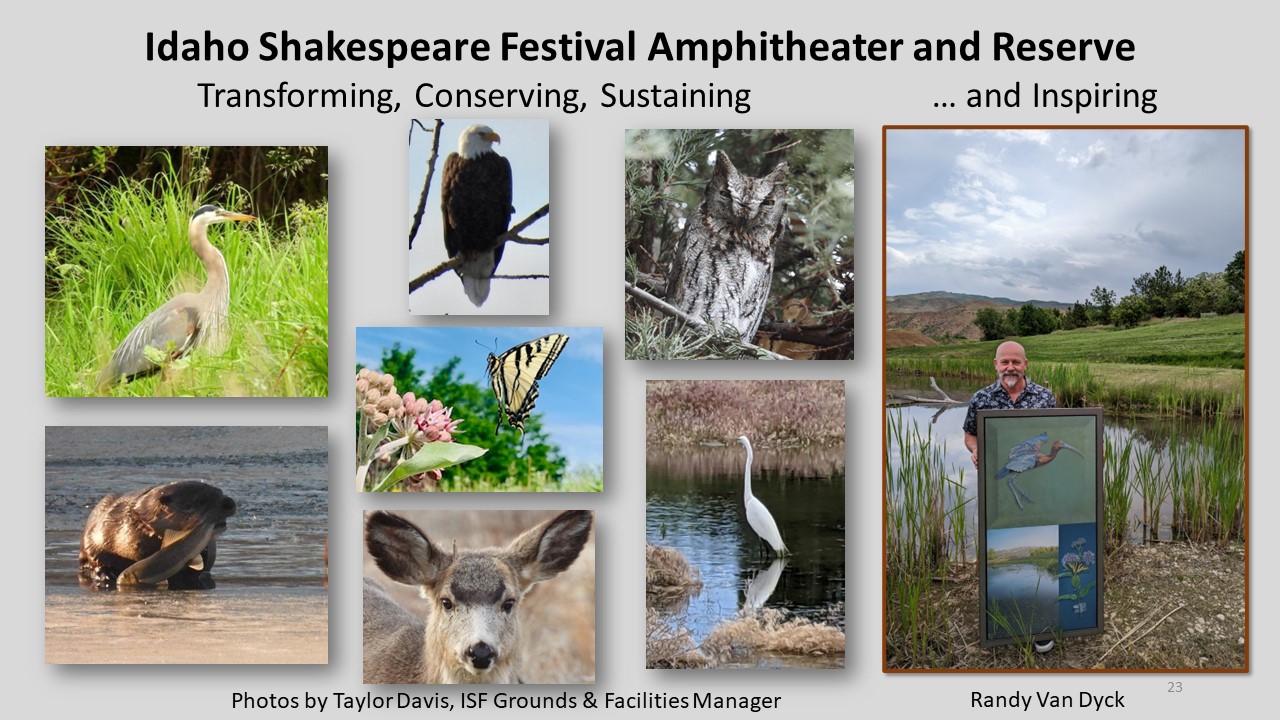
Fred Boelter, PE, in May 2019 interacting with the contractor at The Gateway Reserve Frederick William Boelter of Boelter Risk Sciences and Engineering LLC has since 1973 been professionally assessing, characterizing, communicating, designing, and resolving questions and concerns with his technical and management skills in occupational health, public health, and environmental engineering. Fred’s resume of broad experience encompasses air, water, natural resource degradation, wetland delineations, NESHAP, TSCA, RBCA, NPL, TACAO, Brownfields, product stewardship, ESG, and sustainability. Fred has traveled extensively consulting with clients throughout North, Central and South America, the UK, and Europe as well as more than 30 other countries on a wide range of risk characterization, communication, and management matters. Fred is a member of professional organizations including AWMA, AIHA, ASHRAE, AAEES, and SRA and has served on their boards, committees and presented at numerous conferences both domestically and internationally as well as taught professional development courses and webinars. Fred has also published in peer reviewed professional journals and co‐authored a number of chapters in technical publications. Fred is certified in the Comprehensive Practice of Industrial Hygiene, a licensed Professional Engineer, and a Board Certified Environmental Engineer. Fred is also a Fellow of the AIHA and a recipient of national awards including the Edward J. Baier, the Henry F. Smyth, and the Donald E. Cummings. Fred was the design engineer on The Sacred, The Brownfield, The Gateway Reserve. Many other folks, organizations, governmental agencies, and contractors assisted on this project and are acknowledged in the Project Description of this application for a 2024 award in Excellence in Environmental Engineering and Science. Project DescriptionThe Sacred, The Brownfield, The Gateway Reserve: Recovering the sublime from the mundaneThe Gateway Reserve (TGR) in Idaho is a small project with old sacred roots, Industrial Revolution resource extraction fingerprints, and an existential threat that motivated a drive to secure the future. The Gateway Reserve comprising 12 acres has inspired ‘big impact’ ideas about a Northbank Conservancy seeded with 50 acres along several miles of Boise River riparian habitat (known as the Barber Pool), which sit within Boise Idaho, one of the fastest growing metropolitan areas, now facing development pressure on all sides. Through time immemorial, this area is “Peace Valley”, set on an alluvial fan of the Rocky Mountains along the northern reaches of the Great Basin. Here, at the edge of the largest desert in North America, lies a place called “Cop‐Cop‐Pa‐Ala” by the indigenous Shoshone and Bannock people, used by those who gathered along the river, traded peacefully, and lived with abundant water, plants and wildlife. TGR was created from land intercepted from a home developer in favor of reviving the Peace Valley, where the natural environment is protected and maintained, with appropriate opportunities for humanity to enjoy this special place. In the past 120 years, this area of the 700‐acre Barber Pool was heavily used for ranching, hydroelectric power, brickmaking, a sawmill, agricultural and residential development, and ad hoc recreation. After natural resources were extracted and the area lost its economic viability, it was abandoned as a hub of activity, save for human waste stabilization ponds serving a mobile home community on the site of a former milltown, called Barberton. In the late 1990s, a summer amphitheater was built in what at the time was a remote area six miles upriver from the state capitol. Prior to its first performance, the amphitheater was blessed by Native American tribal members who burned sage and buried the ashes at the foot of the stage. In the 2010s, Idaho Shakespeare Festival (ISF) and its donors raised the funds to purchase the vacated sewage ponds, conducted remediation, and created and connected TGR to the riparian floodway. This small project was astoundingly complex and involved the cooperation of Federal, State, County, and City agencies as well as input from public hearings, testimony from neighborhood associations, and in‐kind donations from consultants and contractors. Design considerations included surface water, groundwater, water rights, FEMA and FERC jurisdictions, and study results authored by the ACoE. Consideration was given the ‘rock crib’ Barber Dam (c. 1904) – whose northern ‘toe’ rests on a corner of TGR – as well as to native xeriscape and ‘wet feet’ tolerant species. The final design was permitted for construction in the spring of 2019, with grading and filling completed during the summer months. However, construction of the wetland itself was deferred due to concerns from an adjacent school about to open its fall semester. In November of 2019, two different native seed mixes were hydroseeded, applying xeriscape to the north 6 acres, and wet feet tolerant to the south 6 acres closer to the water table. The nascent Gateway Reserve was fenced off to allow for springtime germination and sprouting. Then the COVID shutdown occurred and human activity slowed dramatically while wildlife began exploring what had been created. ISF was unable to perform, and the entire season was ultimately cancelled. Plans shifted to a different kind of environmental engineering challenge, namely protecting staff and actors as well as the public in anticipation of how to open a 2021 season. (How this was accomplished was subsequently published in a December 2021 professional journal.) Back at TGR, in December of 2020 a contractor had time and equipment available to grade the designated wetland area and channel, within inches of the water table. Absent a winter demand for surface water used by agriculture, the watermaster released metered river water to fill the wetland, matching the source‐depth prior to opening an excavated connecting channel. In March of 2021, this south channel was opened and within days beavers, ducks, and waterfowl were exploring their new home. Over the ensuing days, weeks, and months, other birds, raptors, mice, deer, bobcat, fox, owls, and coyote were checking out TGR. So were a number of humans who respectfully kept their distance and stayed on the walking bridge and paths. Just a couple months after opening this new south channel, Idaho Shakespeare Festival was successful in mounting a full summer season, implementing an environmental health‐and‐safety policy and program that protected the public, attendees, staff, and actors. The Gateway Reserve has almost 3 years of water level data, a robust and flourishing growth of native vegetation, abundant resident birds and wildlife as well as those that migrate through, a steady stream of area students, bird watchers and others taking a walk and enjoying the uniqueness of this peaceful place. A local artist was so inspired by the transformation from chain link surrounding sewerage lagoons to a gathering place full of life that he painted a triptych featuring a morning view of TGR, a tiger moth feeding on milkweed, and an endangered northern bald ibis that happened to be passing through. In the spring of 2023, the artist submitted this triptych for consideration in the Leigh Yawkey Woodson Art Museum juried Birds in Art show. It was selected and on display until the end of 2023. The Gateway Reserve is a gem that connects, renews, and contributes to the common good. Aside from the funds raised to buy‐out an option and then acquire the land, the 10‐year transformation into today’s Reserve was accomplished through in‐kind donations, volunteer efforts, approximately $25,000 of out‐ of‐pocket expenses, and the generosity of Mother Nature. There are so many people and companies to thank. These include Fred Boelter, PE (Design and Permitting Engineer), scientist Pat Wickman (Forsgren Associates), Taylor Davis (ISF Buildings and Grounds Manager), Idaho Department of Parks and Recreation, Idaho Foundation for Parks and Land, Warner Construction, Veasy Seeding, The Wetlands Group, County of Ada Idaho, City of Boise, Army Corps of Engineers, Federal Energy Regulatory Commission, ISF Board of Directors, and Barber Valley Neighborhood Association. Click images to enlarge in separate window.
Click here to return to the list of 2024 winners. |
||||||||||||||||||||||||||||||||||||||||||||||||||||||||||||||||||||||||||||

Our Partners