- Home
- Contact Us
- News & Events
- Awards
- AAEES Awards Criteria
- 40 Under 40 Recognition Program
- Edward J.Cleary Award
- Excellence in Environmental Engineering and Science Education
- Gordon Maskew Fair Award
- Honorary Member
- International Honorary Member
- Ralph and Joe Bales Graber Science Award
- Stanley E. Kappe Award
- Environmental Communications Awards Competition
- Excellence in Environmental Engineering and Science Competition
- The AAEES Chapter Blue Marble Award
- Resources
- AAEES Microcredentials
- Annual Reports
- AAEES Press Releases
- AAEES Website How To VIdeos
- Environmental Engineer and Scientist
- Environmental Engineering Body of Knowledge
- PFAS Resources
- Specialty Examination Guide
- Students and Young Professionals Resources
- Who's Who in Environmental Engineering & Science®
- Leadership Opportunities
- Membership
- Donate
- Jobs
2020 Excellence in Environmental Engineering and Science® Awards Competition Winner
Grand Prize - PlanningClimate Resiliency and Adaptation PlanEntrant: Orange County Sanitation District Entrant Profile 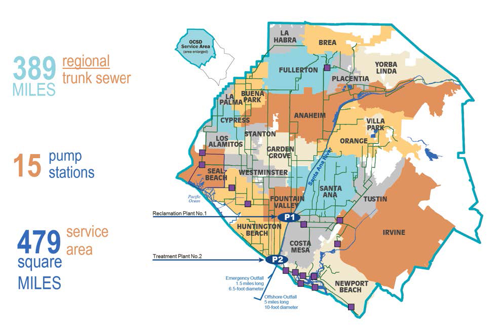
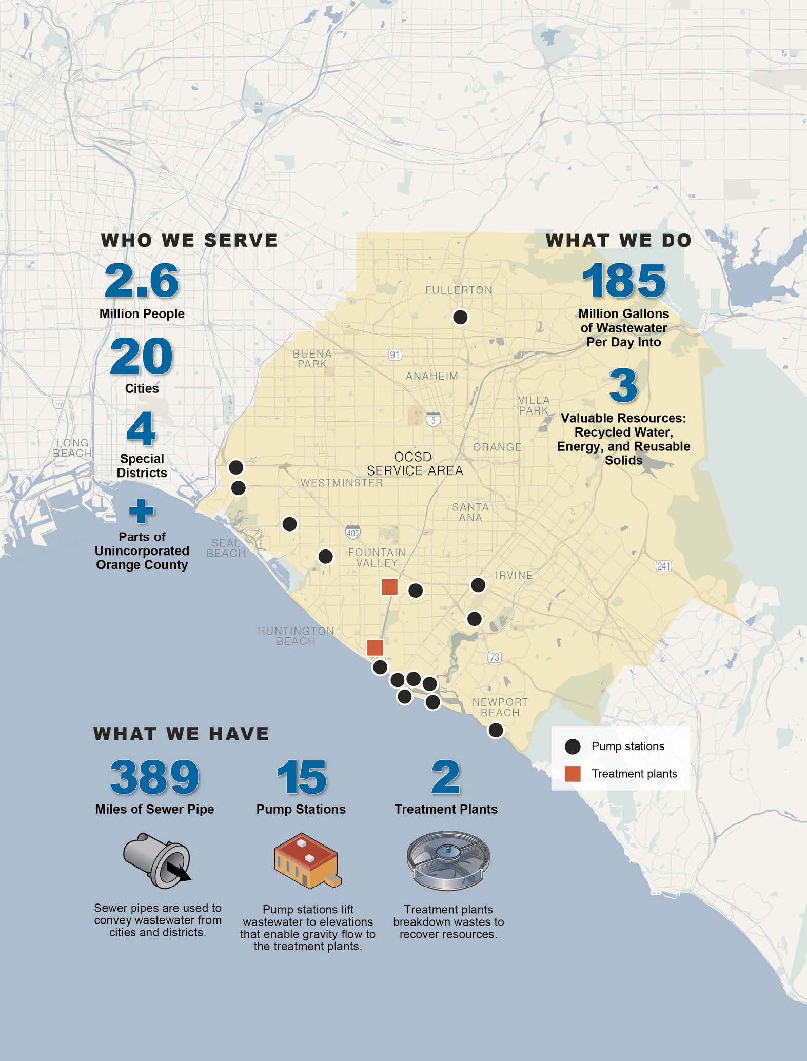
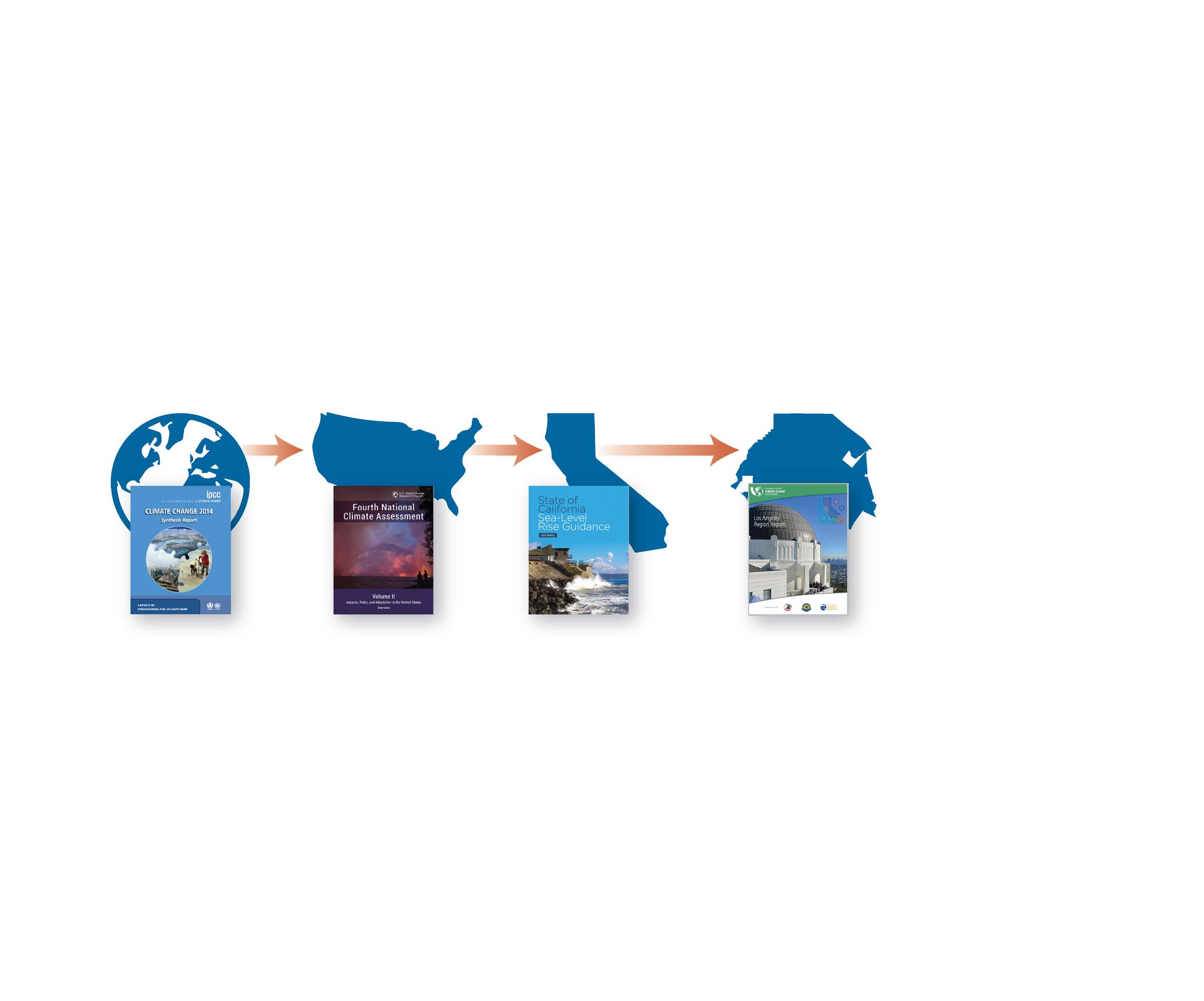
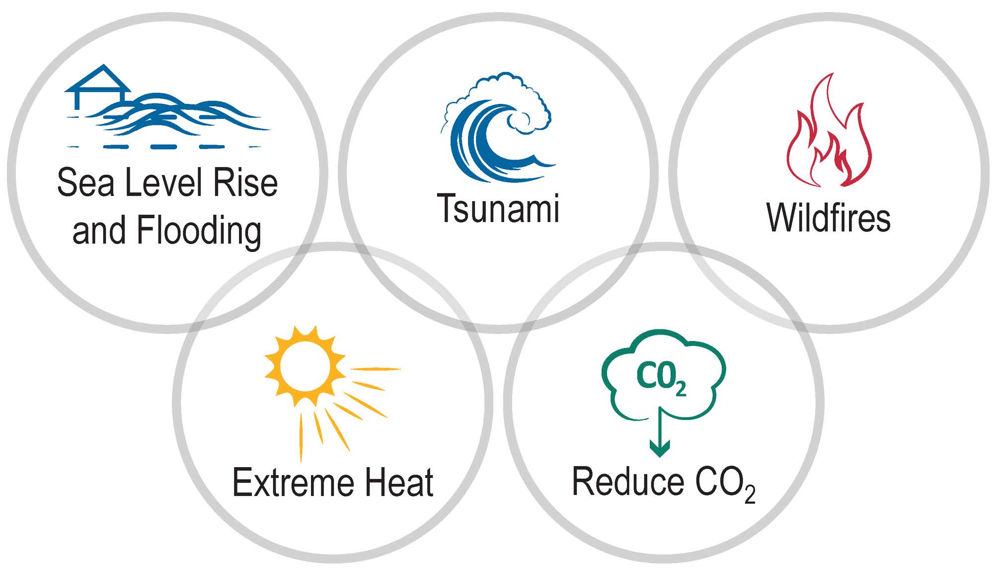
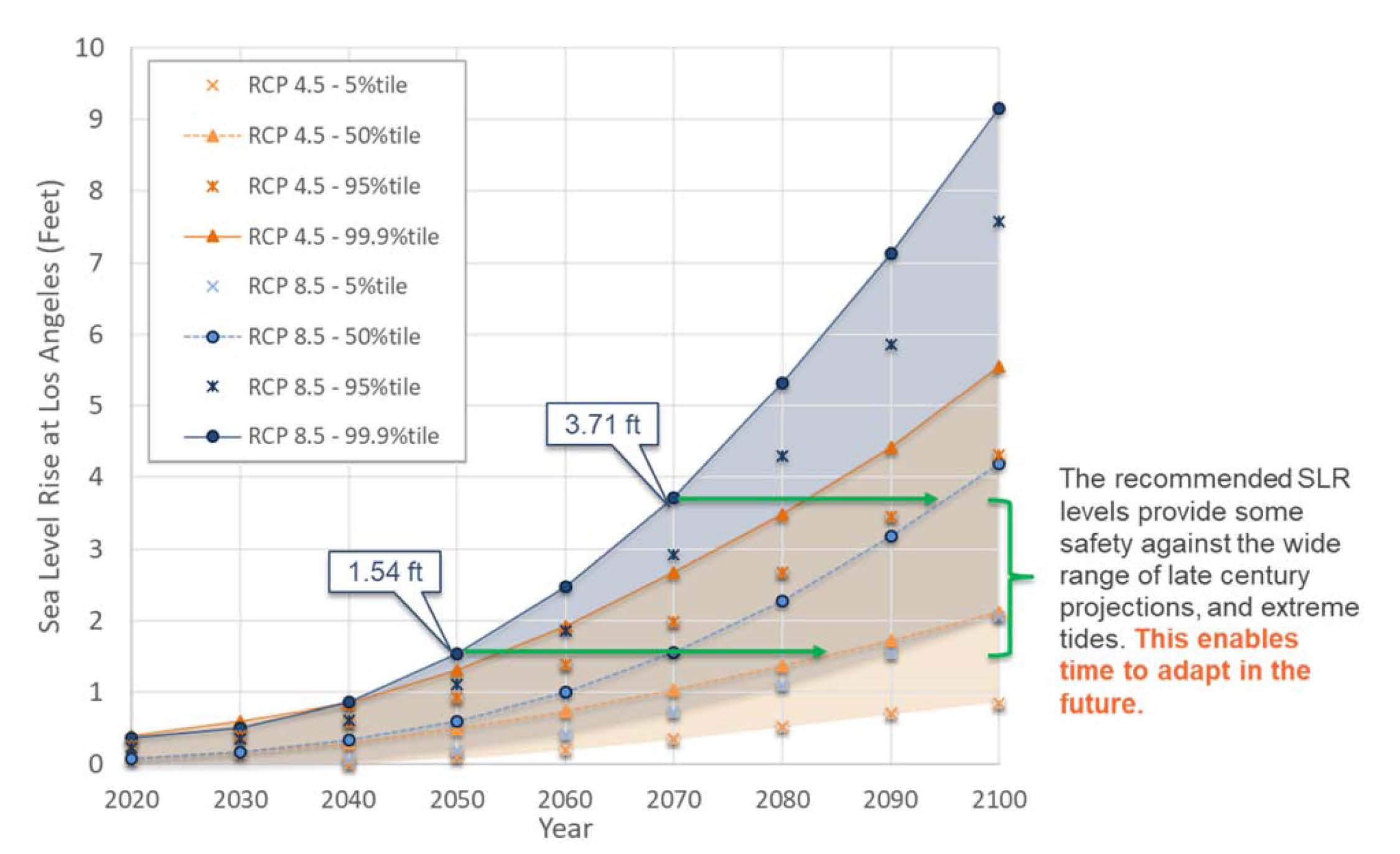
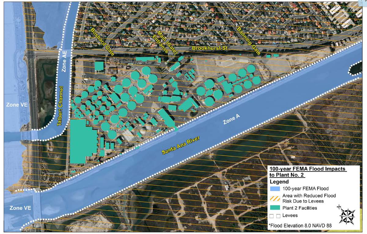
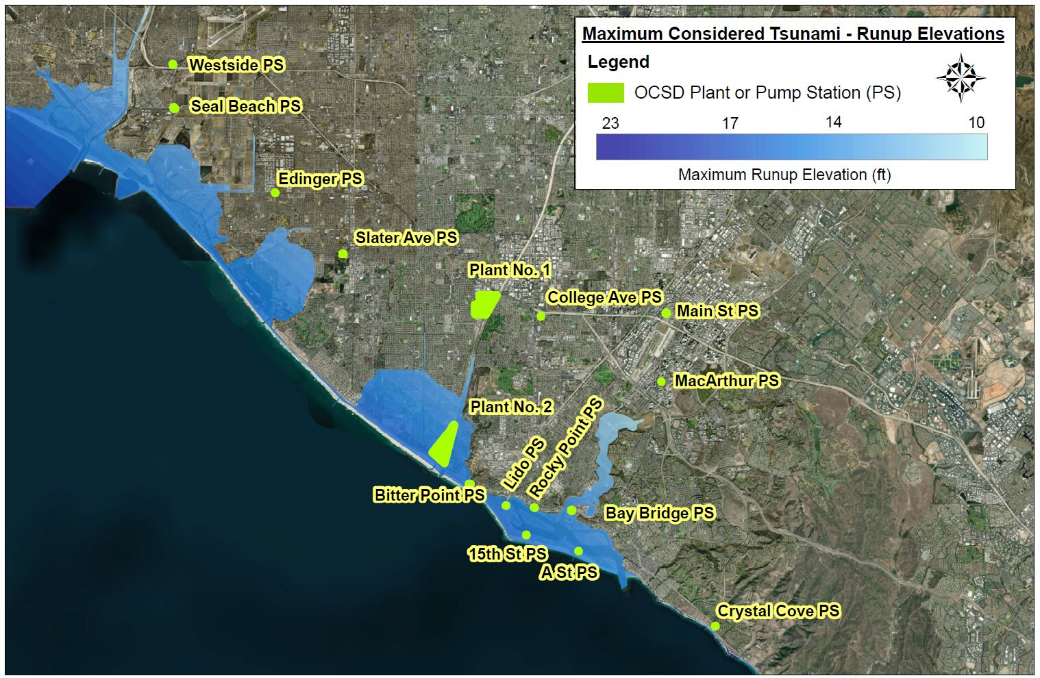
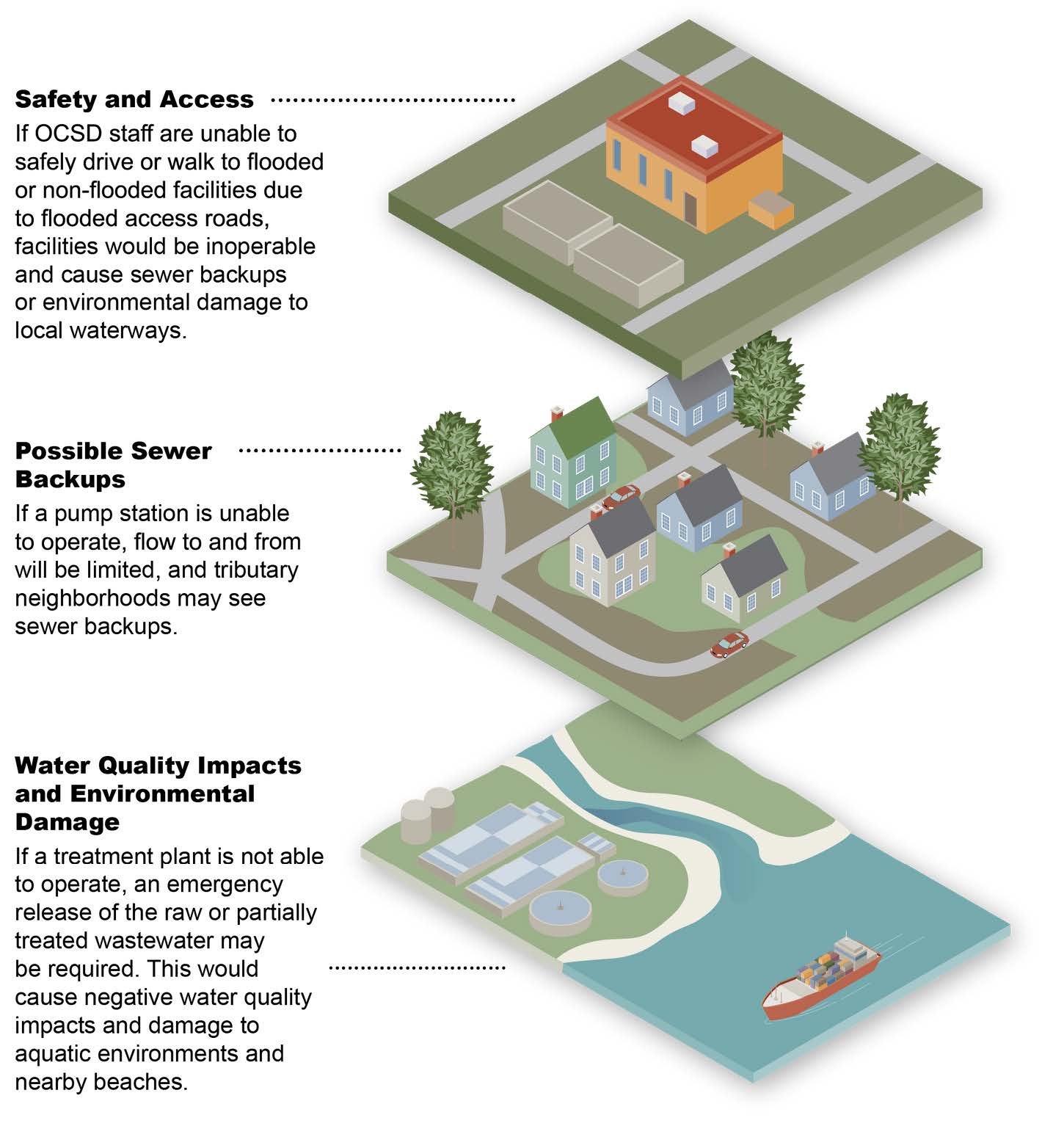
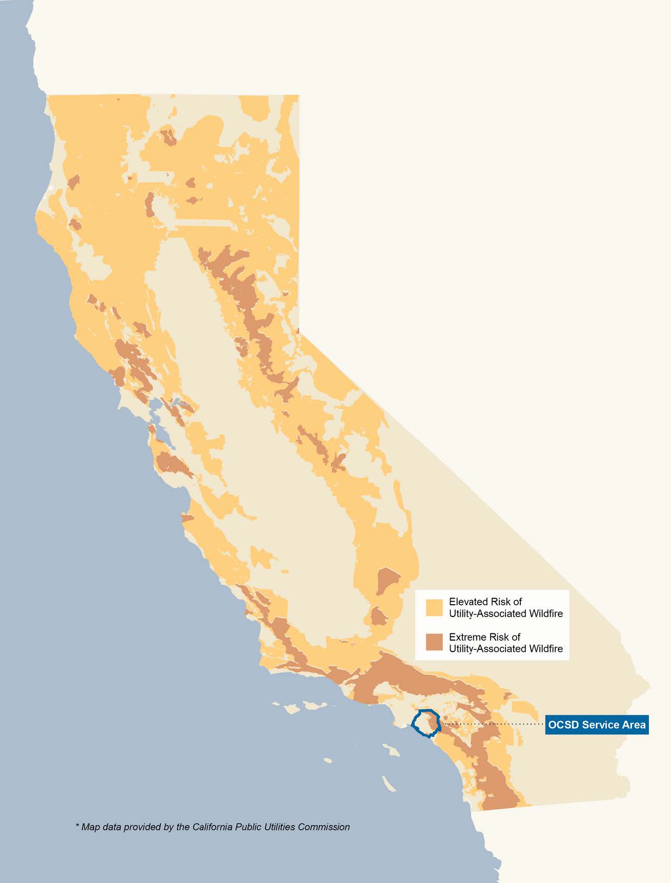
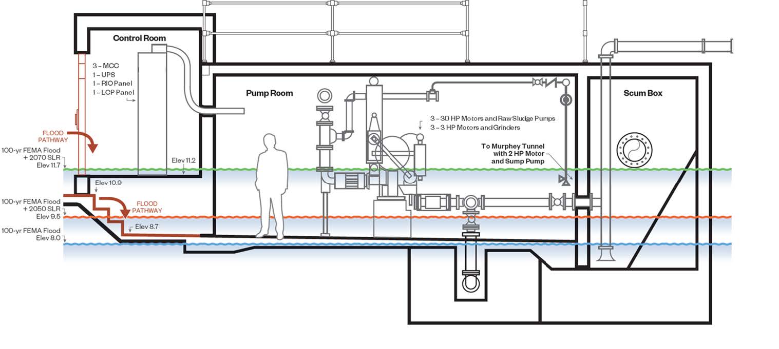
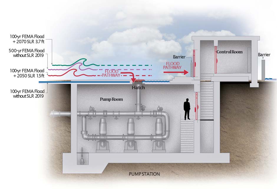
The Orange County Sanitation District (OCSD) is a special district governed by a 25-member Board of Directors comprised of 20 cities, four special districts, and one representative from the Orange County Board of Supervisors. OCSD provides wastewater collection, treatment, and recycling for approximately 2.6 million people living within a 479-square-mile area of central and northwestern Orange County, California (CA). Our facilities include 396 miles of sewer pipes, located throughout the county. Together both plants currently treat nearly 185 million gallons per day (mgd) that is sent to our two treatment plants: Plant No. 1 in Fountain Valley and Plant No. 2 in Huntington Beach, CA. Located in the second most densely populated county in the state, OCSD has operated since 1954 and is the third largest wastewater agency west of the Mississippi River. OCSD is tasked with providing services to 2.6 million people and this is bound to get more challenging as climate change threatens to increase the risk posed by natural hazards to our economy, infrastructure, and health. To minimize the risks posed by climate change to their facilities, the Orange County Sanitation District conducted a Climate Resiliency and Adaptation Plan that involved assessing the risks posed by climate change and developing adaptations to mitigate those risks. Project DescriptionOverviewClimate change threatens to increase the risk posed by natural hazards to OCSD facilities – risks that have serious implications for public, staff, and environmental health within and around OCSD's service area. To minimize the risks posed by climate change, OCSD conducted a Climate Resiliency and Adaptation Plan that involved assessing the risks and developing adaptations to mitigate those risks. Comprehensive and Integrated ApproachOCSD's treatment plants and pump stations were evaluated for the risks posed to their operations by flooding, tsunami, wildfire, and extreme heat, and how climate change is expected to exacerbate these risks. Flood risk was evaluated by first determining 100-year flood levels associated with OCSD facilities. Data from California's 4th Climate Change Assessment was used to develop projections for sea level rise (SLR) for 30-year and 50-year planning horizons, corresponding to years 2050 and 2070. The risk of flood during a 100-year storm without SLR (i.e., the current 100-year flood risk) and the flood risk with SLR in 2050 and 2070 were evaluated for all OCSD facilities using GIS mapping techniques. This analysis allowed identification and marking of flood pathways into facility boundaries. In a more detailed assessment, flood pathways into individual buildings were identified by extracting elevations of doorways, louvers, and other openings for water flow and tracked in a database so that those elevations could be compared to projected flood levels. Record drawings for buildings with flood pathways below pKrojected flood levels were further evaluated to extract elevations of critical assets and identify their flood risk. These analyses indicated that Plant No. 2 and four pump stations would be impacted by flooding with SLR. 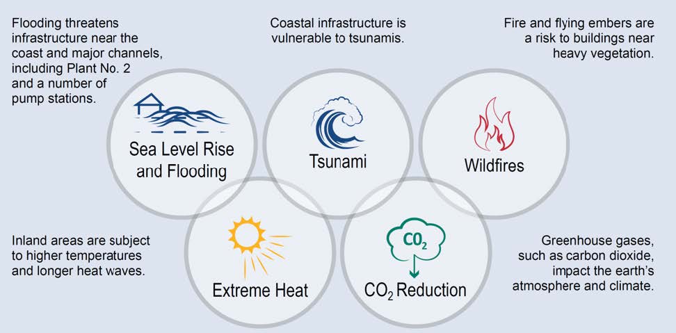  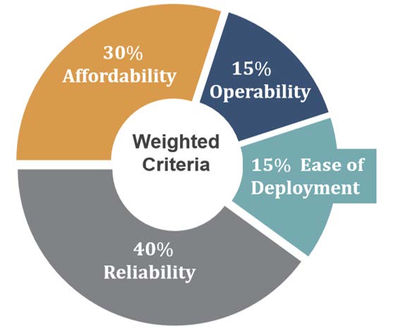 Tsunami risk was identified for OCSD facilities by identifying tsunami runup elevations using the American Society of Civil Engineers Tsunami Hazard Tool. The tsunami runup elevations were compared to OCSD facility site elevations using GIS mapping, similarly to the analyses performed for 100-year flood and SLR flood risk. Wildfire and extreme heat risks were evaluated using data from California's 4th Climate Change Assessment and from the State of California's Cal-Adapt website. Based on this data, wildfire and extreme heat risks were found to be generally low in the vicinity of OCSD's facilities, so adaptations were not considered beyond those that already exist in OCSD's design guidelines and emergency response plans. Building, operational, and asset-level solutions were evaluated for all facilities, and for Plant No. 2 a boundary-level adaptation was also developed. For Plant No. 2, a boundary-level solution of flood walls and flood gates was recommended as the most sustainable adaptation strategy to protect impacted facilities within the plant. The flood wall and gates would be built to an elevation that will protect the plant against a 100-year flood with projected SLR in 2070 and withstand tsunami forces. The multi-criteria analysis indicated that the most sustainable adaptation strategy for impacted pump stations was a building-level solution of stop logs and watertight drywell hatches. The selected adaptation strategies were found to protect the highest value of assets while providing a high level of reliability, minimal deployment requirements, and few impacts on operability compared to asset- and operational-level adaptation strategies. Figure below shows an example of facility level adaptation for a typical pump station. Originality and InnovationThe main obstacle encountered by the OCSD Climate Resiliency and Adaptation Plan is that climate resiliency is a relatively new field, with few examples available for how to integrate the findings of climate scientists into wastewater facility design, operations, and emergency preparedness. This obstacle was overcome by working with a multidisciplinary team to develop practical solutions while referencing the latest developments in climate science and emergency preparedness. The pragmatic approach used in this project stands out among the high-level climate change studies being conducted throughout the state and the nation. While wastewater facilities have been designed for static design conditions in the past, climate change has ushered in a new paradigm of facility design and emergency preparedness. The OCSD Climate Resiliency and Adapation Plan is one of the first projects in California broadly and Orange County specifically to integrate the implications of climate change into improved design standards, emergency preparedness, and facility operations for the future. To incorporate resilient measures in an efficient and cost-effective approach, specific adaptation strategies were recommended to be added to future Capital Improvement Projects for impacted facilities. Complexity of the Project ApproachedExisting adaptations to climate risks were identified in OCSD emergency response plans and design guidelines. Although OCSD's existing design standards and emergency response plans already contained adaptations to flood conditions due to storms and tsunami, opportunities were identified for increasing resilience though evaluation of additional adaptation strategies. A multi-criteria analysis was performed to determine the most sustainable type of adaptation to use at each facility impacted by flooding. The criteria used in this analysis consisted of adaptation costs, reliability, deployment time, and operational impacts. Each criterion was weighted differently through focused meetings and workshops between consultants and OCSD staff and management. Contribution to Social and Economic AdvancementOCSD's Climate Resiliency Plan presents an example for professionals working in the water and wastewater industry of how to adapt existing facilities to a changing climate and how to prioritize adaptation strategies. The Plan also helps inform designers of new facilities about what should be considered for building a new facility that is resilient to climate change. The investment made in climate resiliency now will minimize risk and financial burden during future extreme climate and natural events that are exacerbated by climate change. The project brings a new and multidisciplinary approach to wastewater engineering that takes into consideration the most recent climate science and integrates it with traditional approaches to facility design, system operations, and emergency preparedness. Although regional water quality control boards are beginning to require climate resiliency plans for permit renewal, OCSD took the initiative to develop a climate resiliency plan in advance to integrate climate resilience into the ongoing CIP in order to maximize public, staff, and environmental health and safety. As a result, climate resilience can be achieved while maintaining OCSD's progress on the entire collection system and reclamation facilities. Click images to enlarge in separate window.
Click here to return to the list of 2020 winners. |
Our Partners