- Home
- Contact Us
- News & Events
- Awards
- AAEES Awards Criteria
- 40 Under 40 Recognition Program
- Edward J.Cleary Award
- Excellence in Environmental Engineering and Science Education
- Gordon Maskew Fair Award
- Honorary Member
- International Honorary Member
- Ralph and Joe Bales Graber Science Award
- Stanley E. Kappe Award
- Environmental Communications Awards Competition
- Excellence in Environmental Engineering and Science Competition
- The AAEES Chapter Blue Marble Award
- Resources
- AAEES Microcredentials
- Annual Reports
- AAEES Press Releases
- AAEES Website How To VIdeos
- Environmental Engineer and Scientist
- Environmental Engineering Body of Knowledge
- PFAS Resources
- Specialty Examination Guide
- Students and Young Professionals Resources
- Who's Who in Environmental Engineering & Science®
- Leadership Opportunities
- Membership
- Donate
- Jobs
2026 Excellence in Environmental Engineering and Science® Awards Competition Winner
Superior Achievement
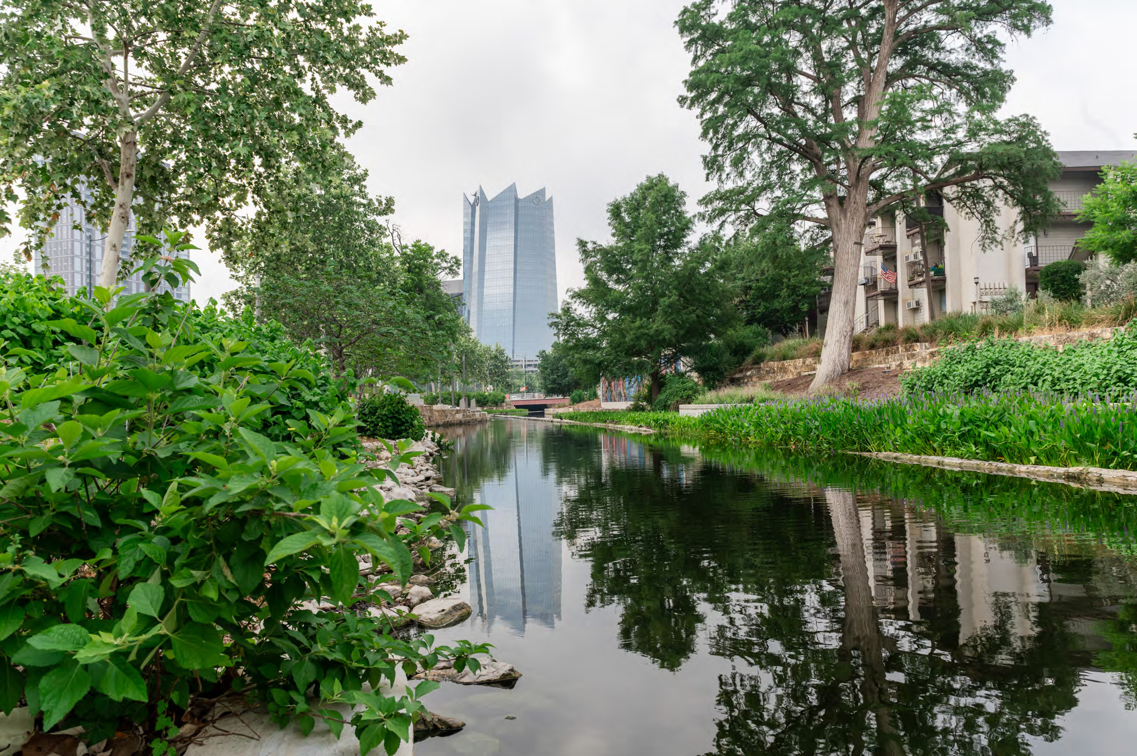
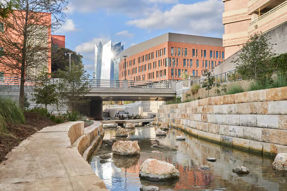
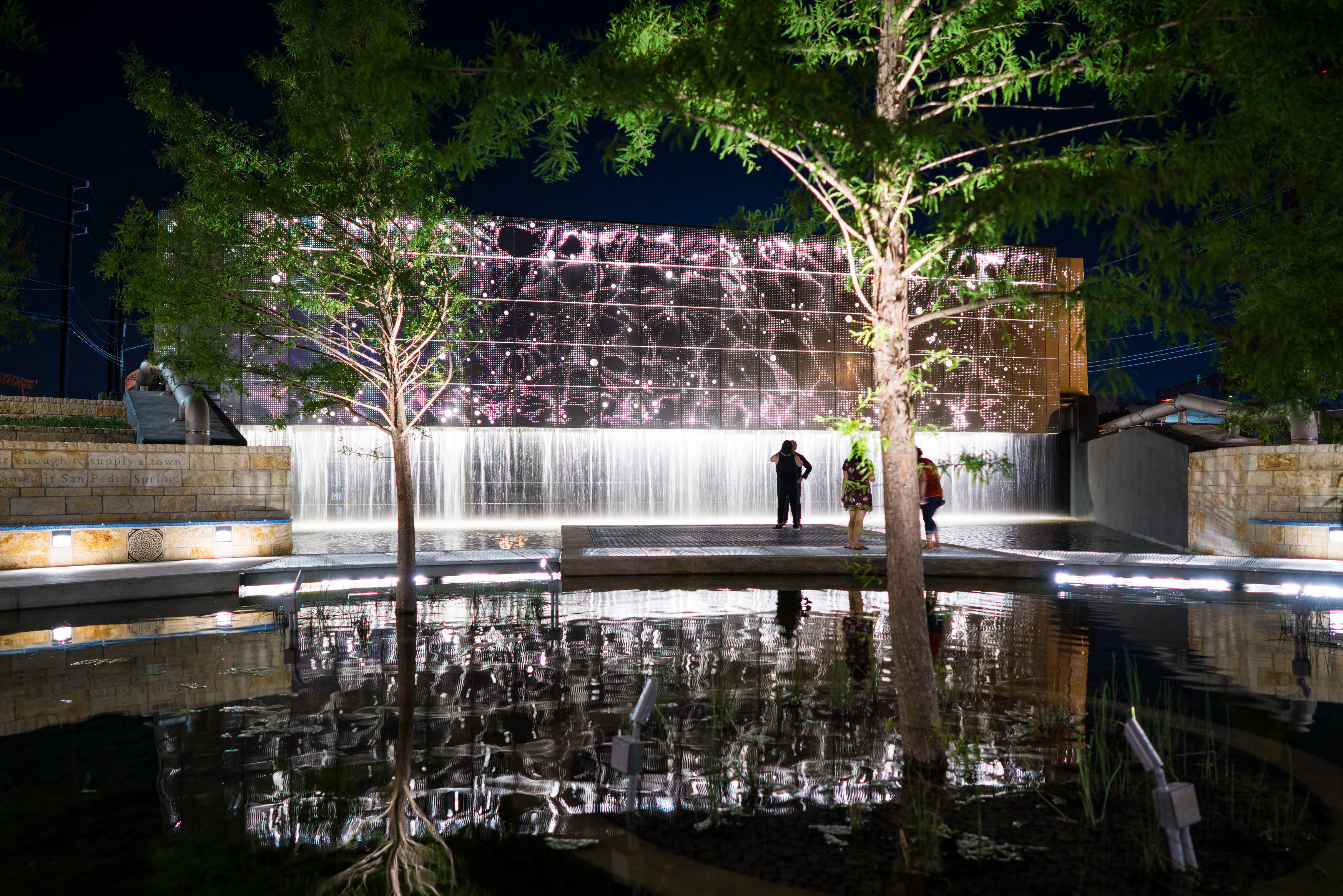
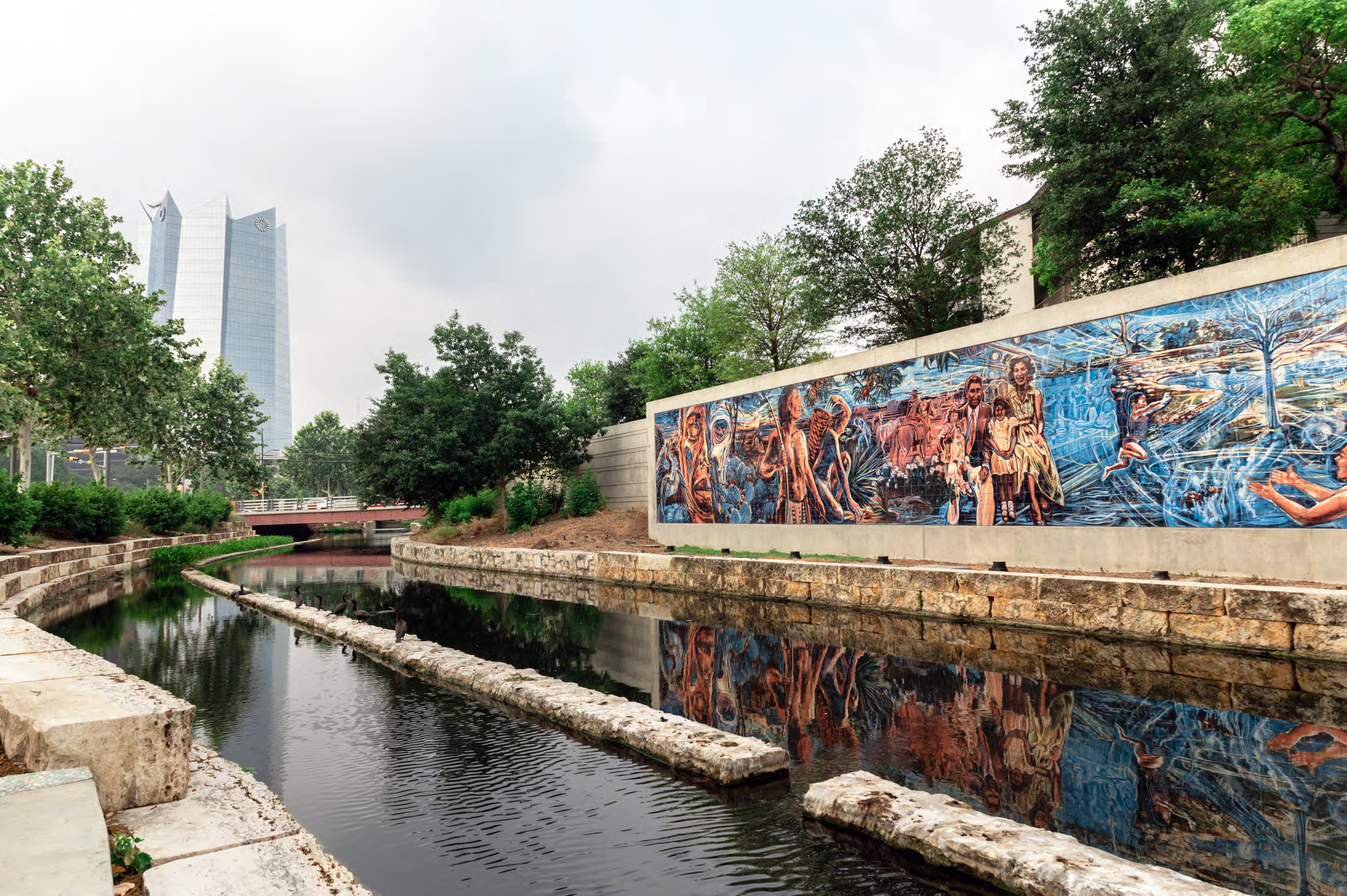
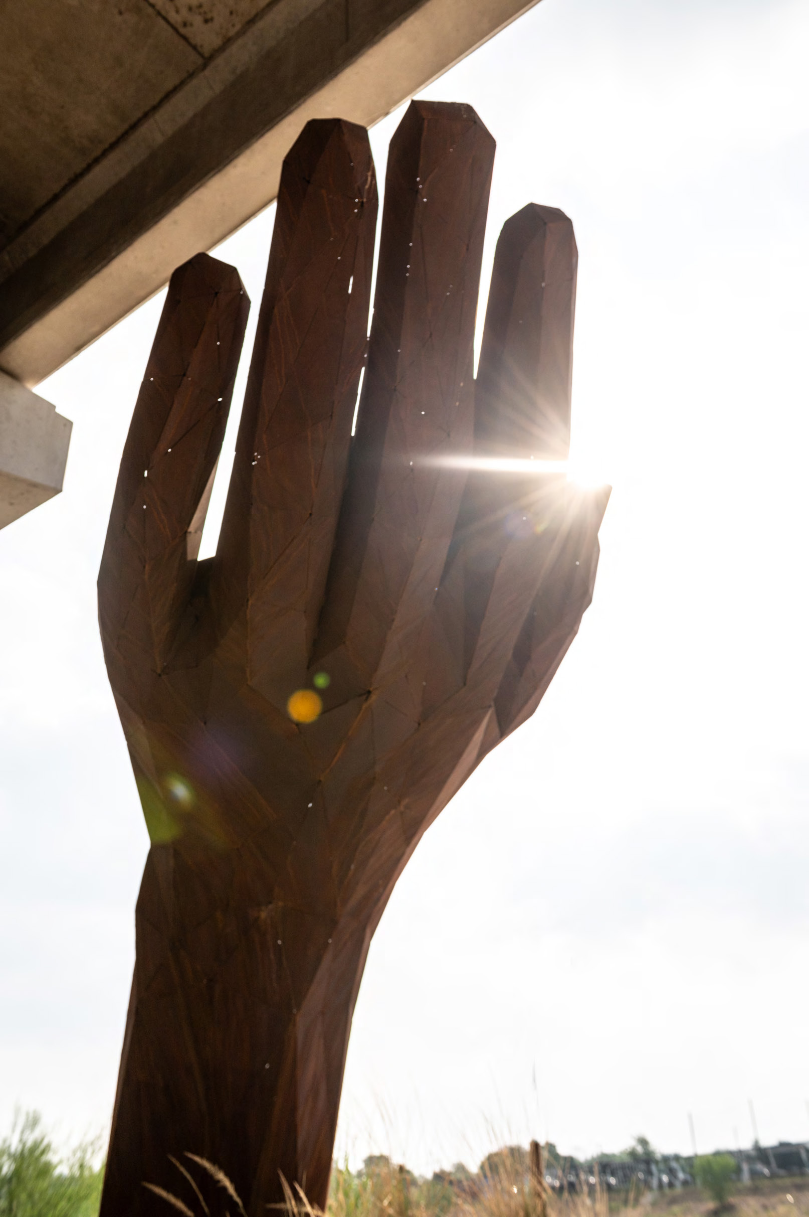
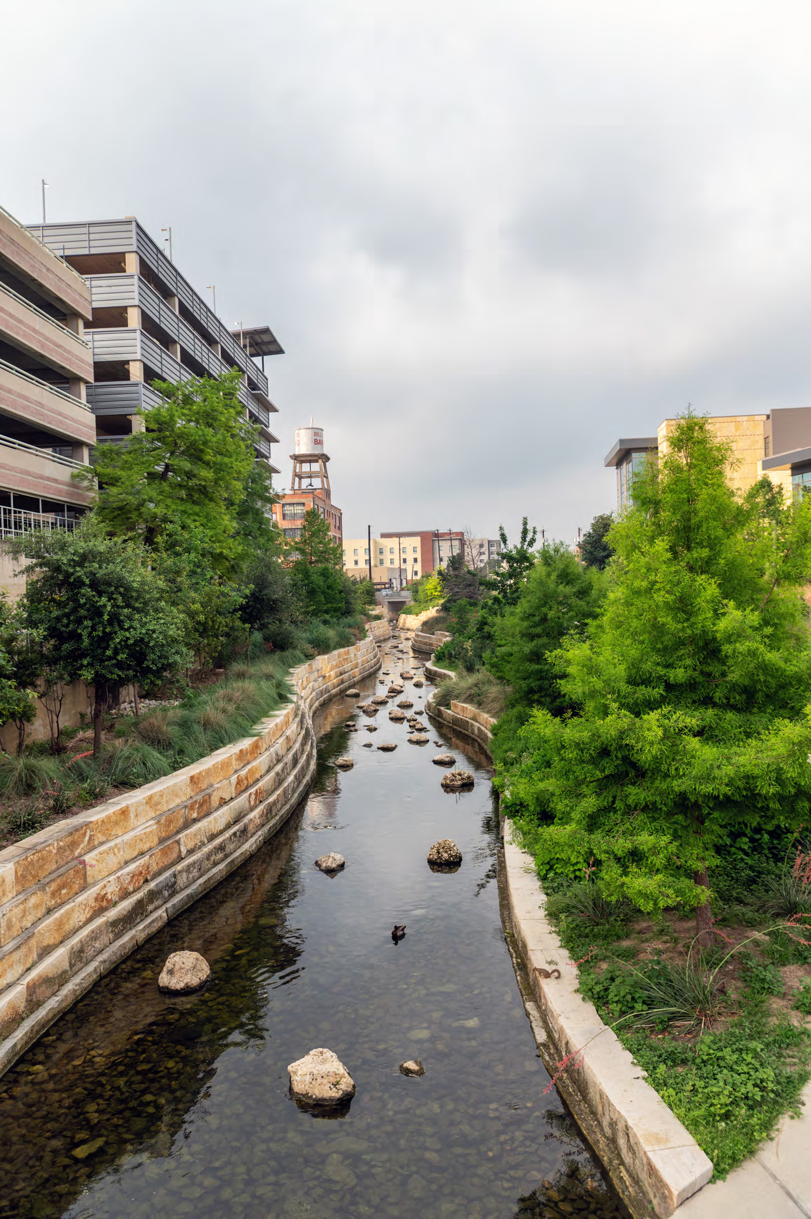
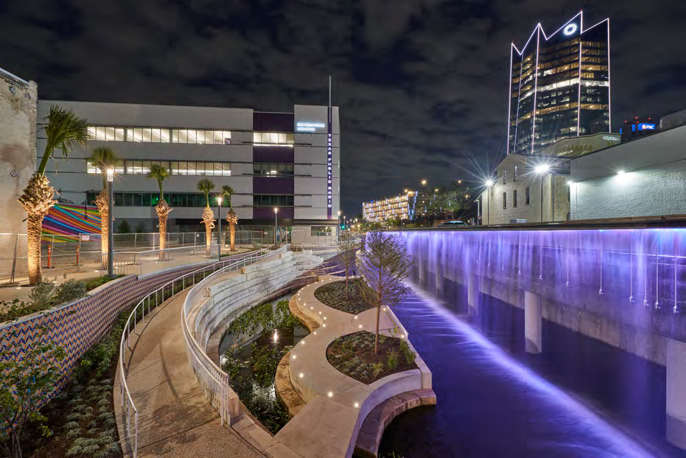
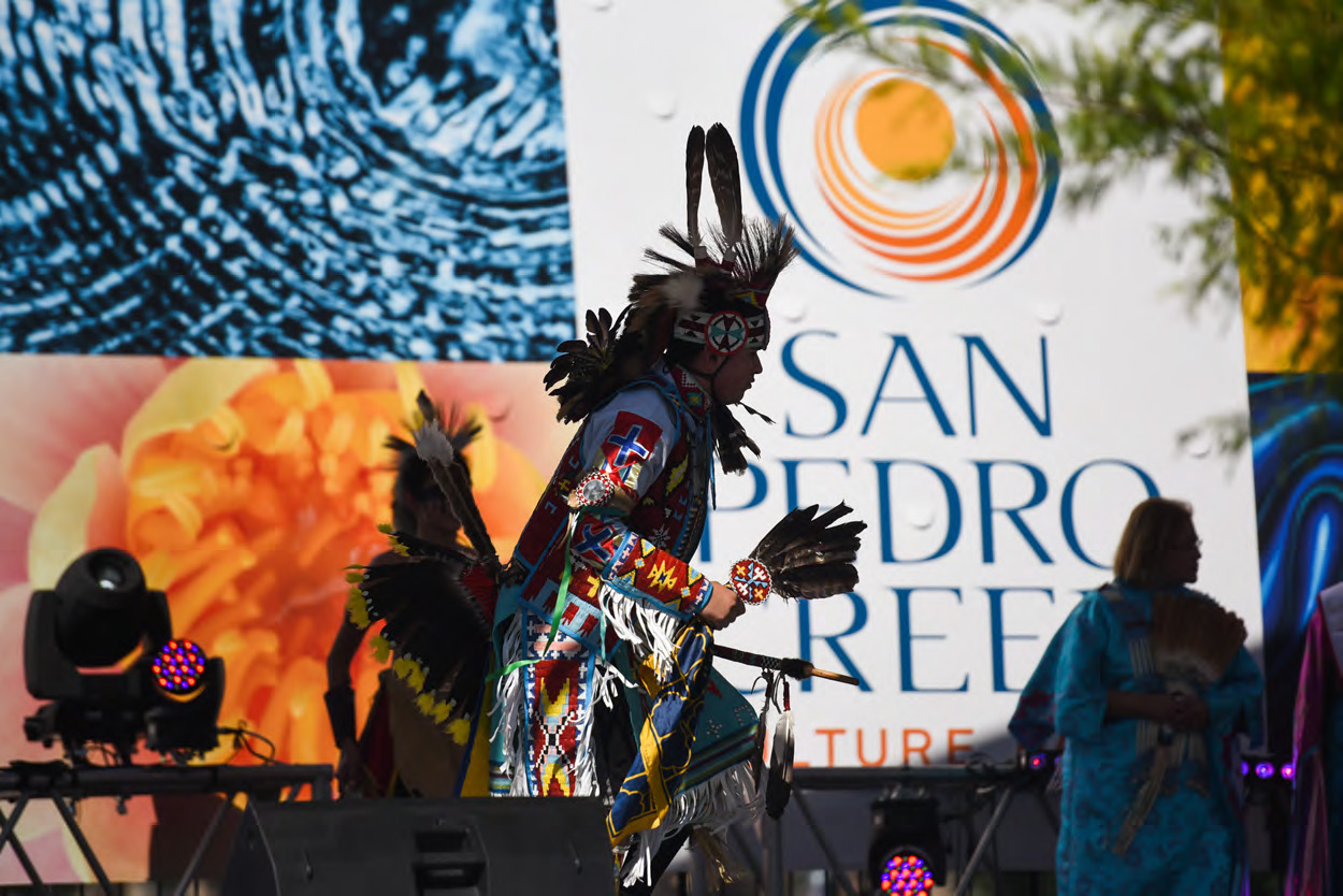
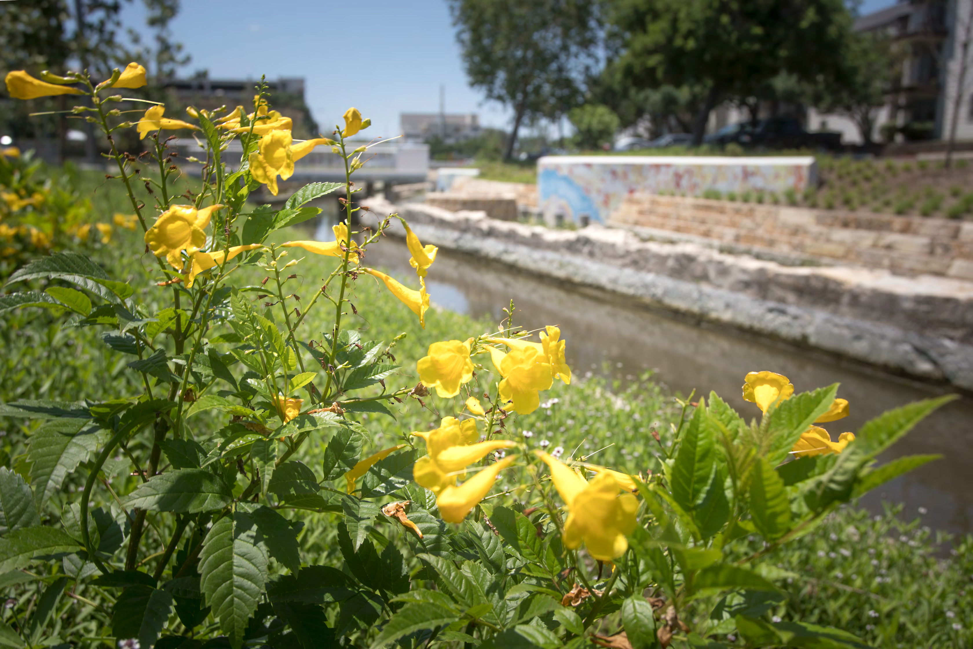
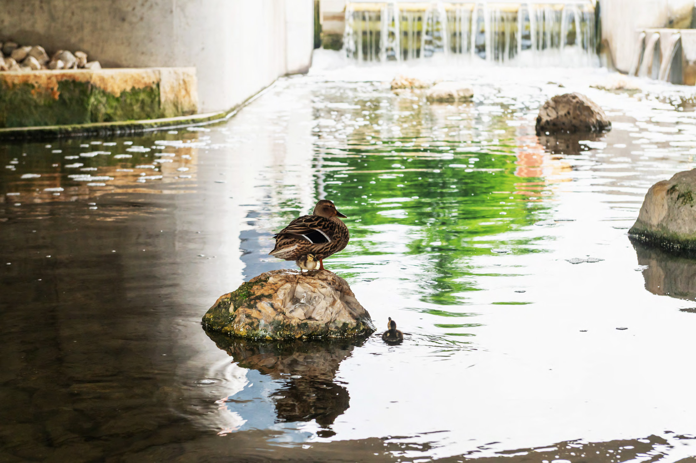
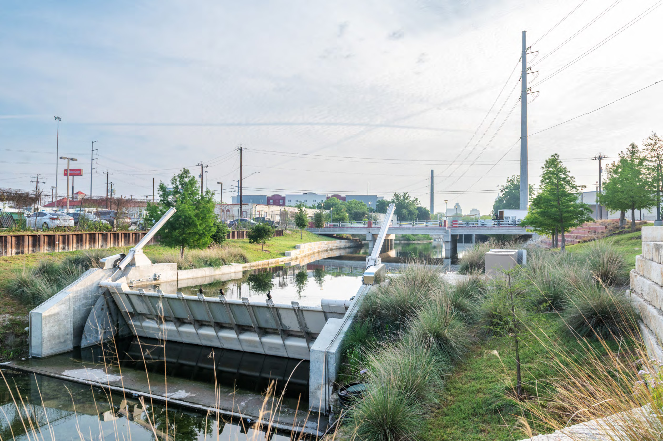
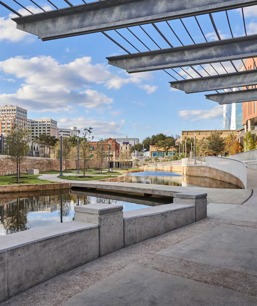
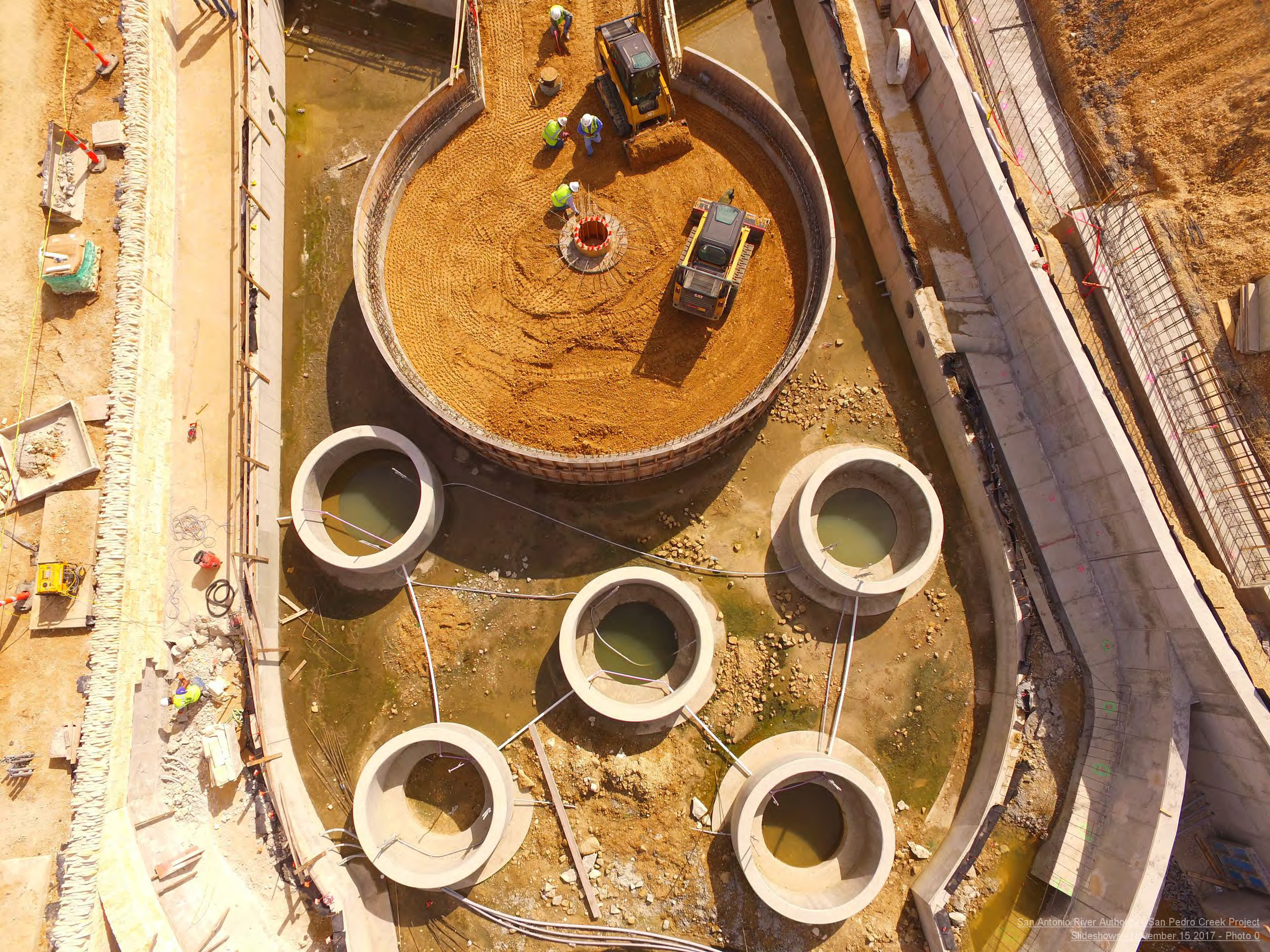
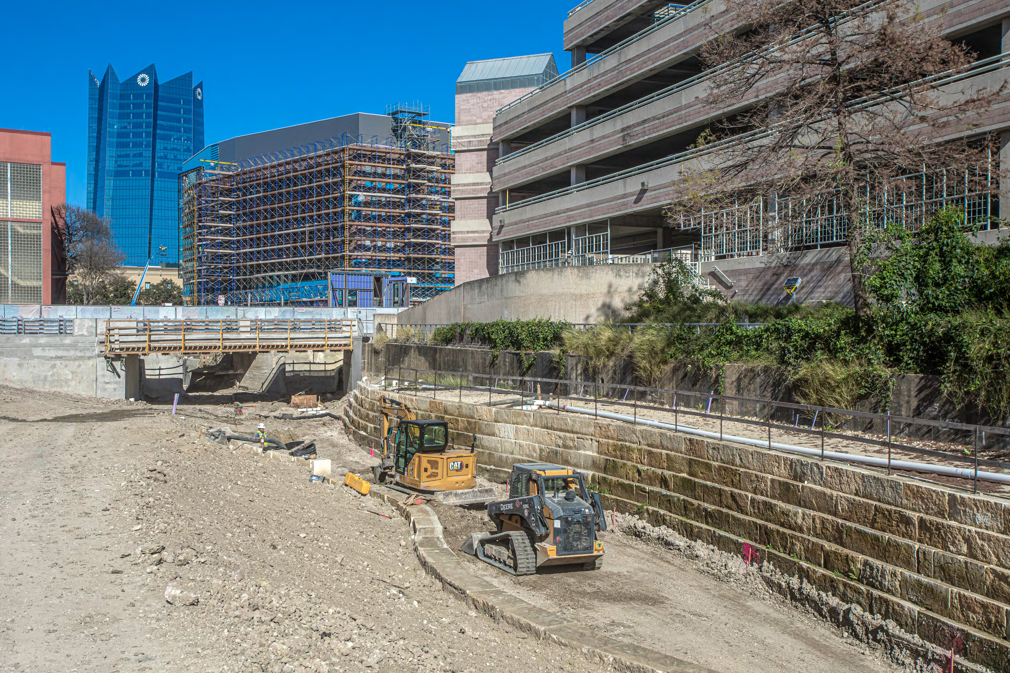
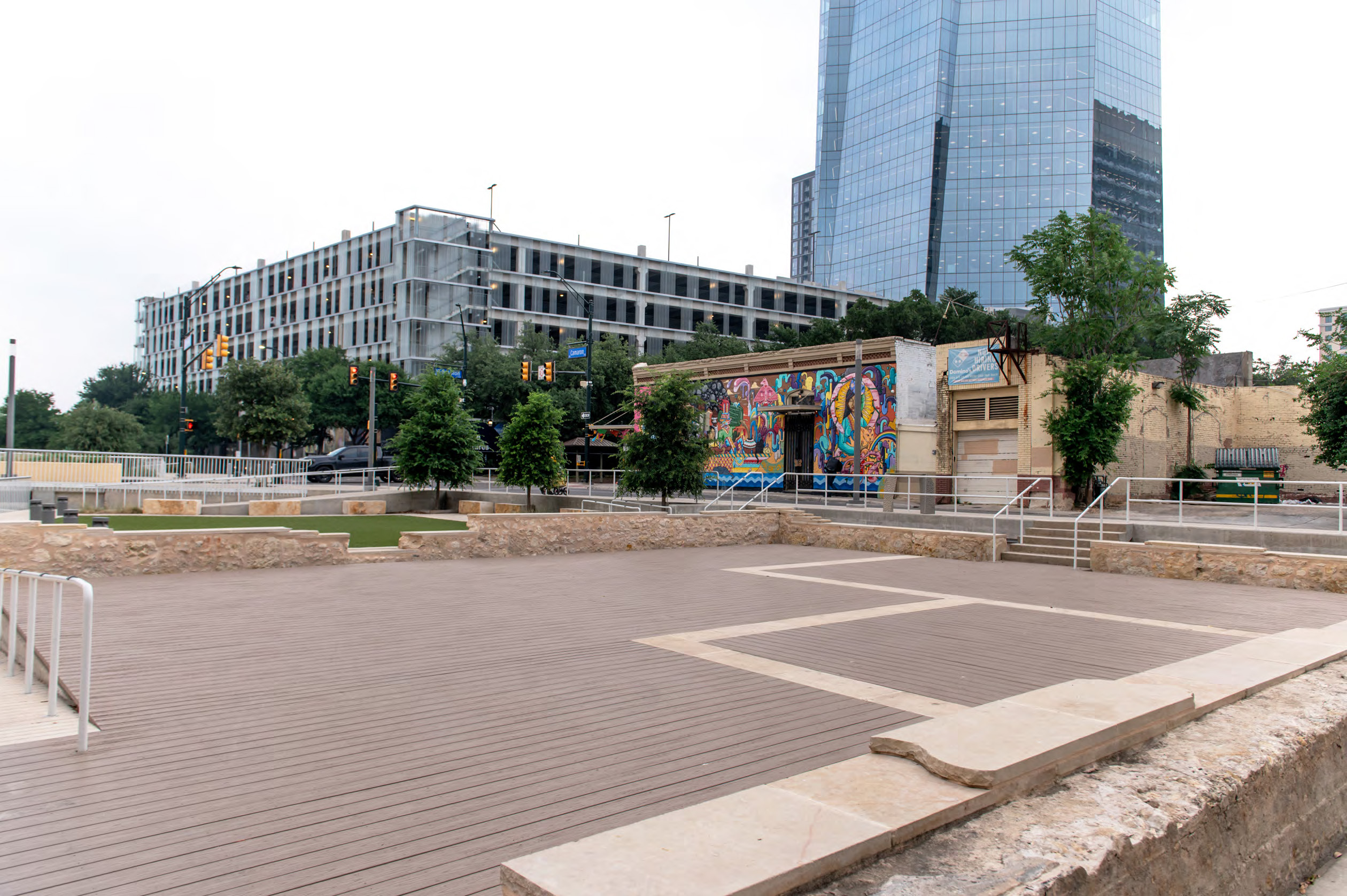
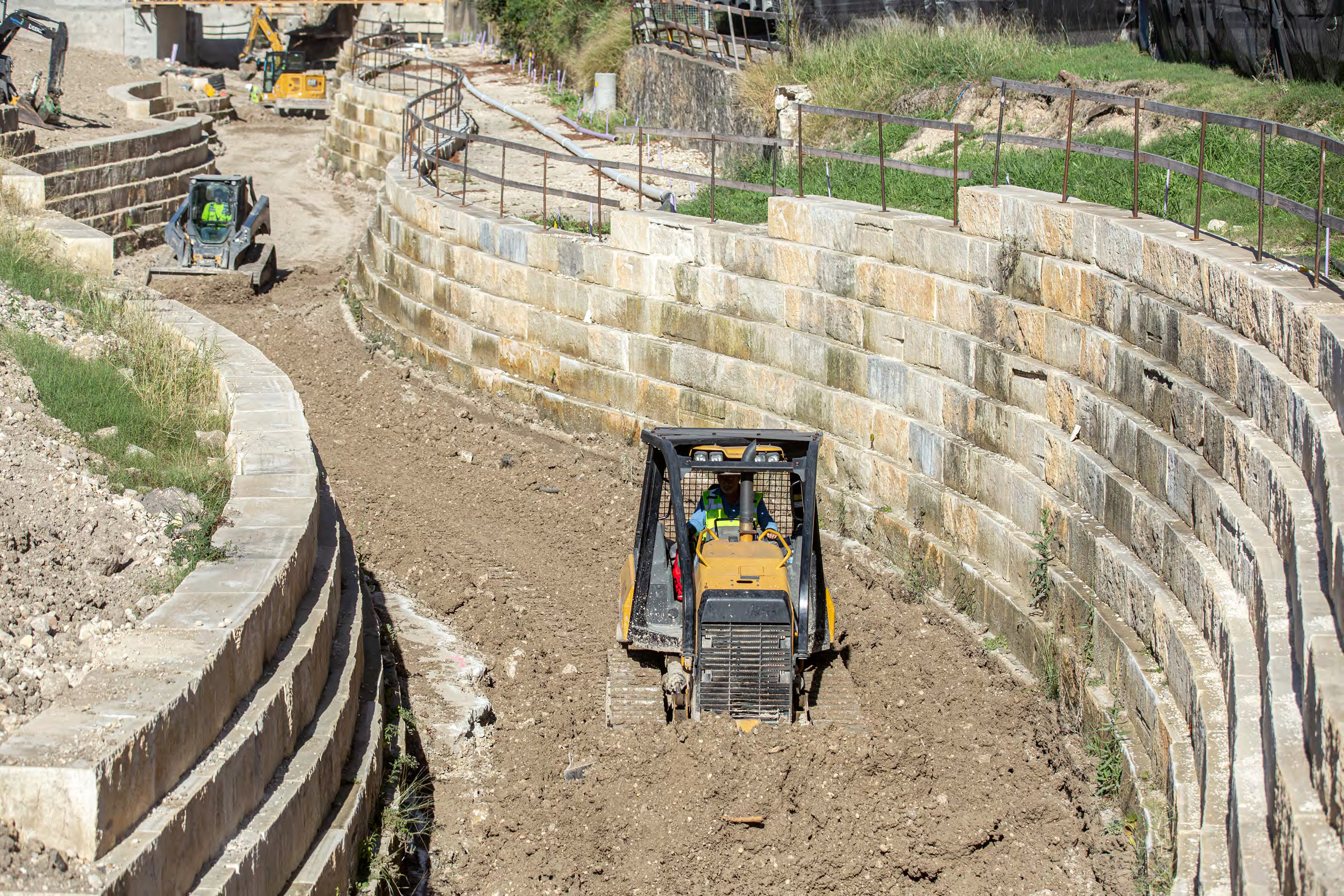
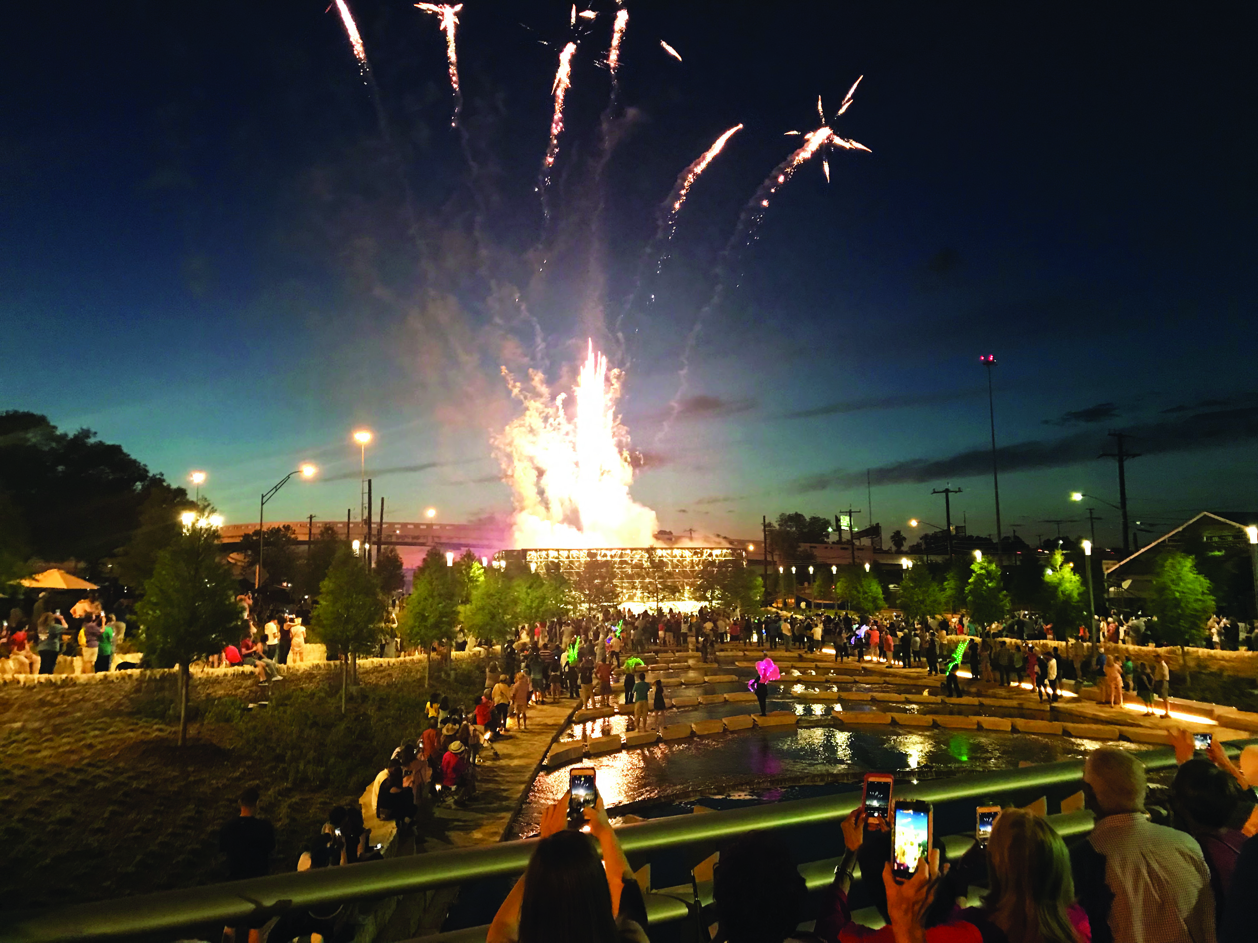
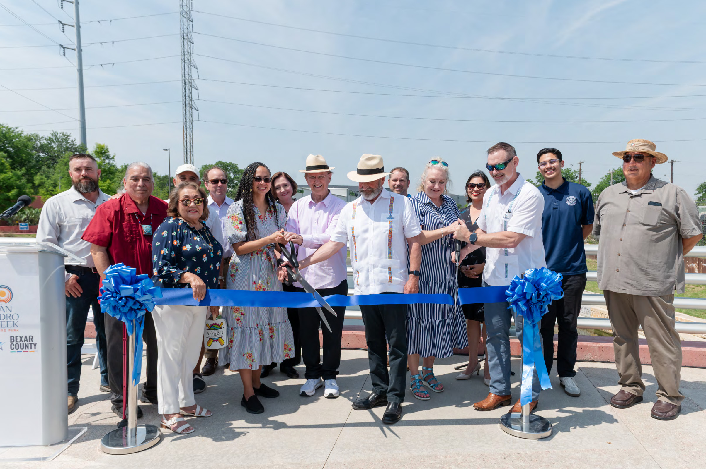
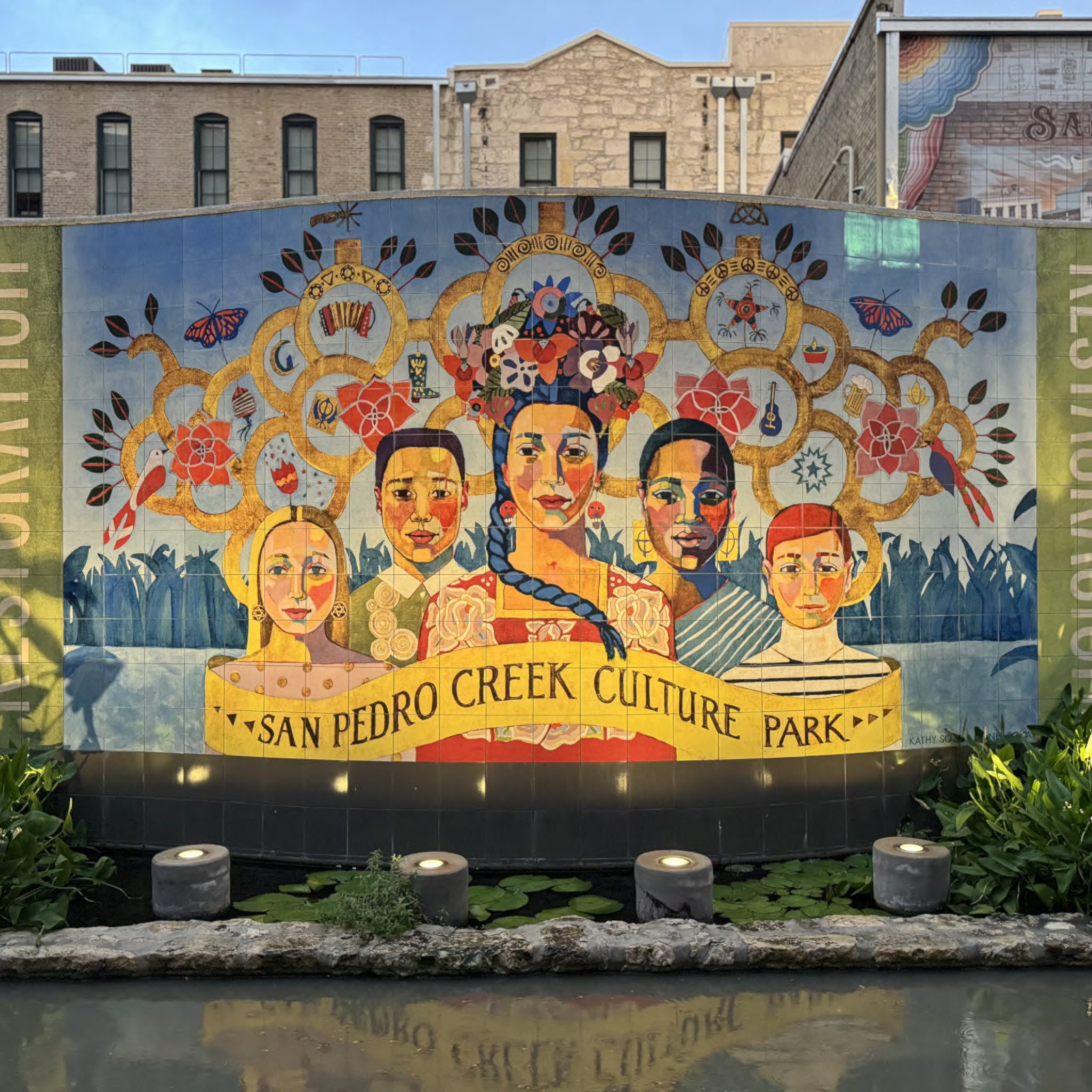
Category Entered: DesignSan Pedro Creek Culture ParkEntrant: HDR Entrant Profile In coordination with the City of San Antonio and Bexar County, the San Antonio River Authority hired the HDRteam to lead engineers, architects, and scientists to revitalize the San Pedro Creek corridor. As the primeconsultant for the San Pedro Creek Culture Park project, the HDR team transforming the two-mile stretch into alinear creekway complete with art, walking paths, park areas, and many other amenities. They did all this while accomplishing the primary goal: flood control. The project transformed the creek into a reflection of its place in the city’s cultural history, revitalized natural habitats and water quality, and catalyzed economic development. Project DescriptionDemonstration of a comprehensive, integrated approach that considers all environmental media, i.e., air, water, and land. For example, solution of an air pollution problem must not create a land disposal problem or an adverse water impact that is not addressed by the project.The San Antonio River Authority’s (SARA) 2.2-mile project seamlessly integrates flood control, water quality improvements, ecological restoration, and cultural celebration while exceeding traditional performance metrics. Where concrete walls once divided neighborhoods, a living corridor protects against 100-year floods while creating spaces that draw people together. This integrative approach required seamless coordination between engineers, architects, artists, historians and stakeholders. The result establishes new benchmarks for infrastructure development. While traditional engineering solutions prioritized single-purpose functionality, San Pedro Creek Culture Park achieves superior flood protection while catalyzing economic revitalization and strengthening community connections. It’s proof that essential infrastructure can enhance rather than divide communities. Quality as evidenced by the degree of user satisfaction and proven performance. (For RESEARCH projects, testimony of experts in the field as to the quality and importance of the research will be used in lieu of user satisfaction or proven performance. For REGULATORY PROGRAMS, quality will be decided based on demonstrable impacts of the effort.)Delivering this historically significant project on schedule reinforced public trust in the ability to execute complex, community-centered projects. The most critical milestone—completing Phase 1 by May 2018 for San Antonio’s tricentennial celebration—allowed no margin for error. This deadline’s cultural significance created intense pressure to overcome obstacles through innovative solutions and extraordinary effort. The team implemented multiple shifts, expedited procurement, and developed contingency plans for critical path activity to maintain schedules. Although the phases finished out of order because of different challenges and site conditions, each milestone was achieved. The final phase’s completion in May 2025 marked not just the end of construction but the beginning of a new chapter for San Pedro Creek as part of San Antonio’s identity. Originality and innovation, representing the application of new knowledge, a new application of existing knowledge, or an innovative mix of existing knowledge.To contain the 100-year floodplain within the creek banks, the team turned to extensive hydraulic modeling and innovative channel design. This includes sophisticated crest gates that precisely control the water surface level – maintaining deeper pools to support aquatic habitats during normal flows and lowering to increase channel capacity during high-flow conditions. Eighteen continuous deflective separation units—large, underground hydrodynamic separators that use swirling motion to remove trash, sediment, and hydrocarbons from stormwater. Operating without external power, these rely on the energy of flowing water to separate pollutants before discharge into the creek. Complementing the CDS units, a network of bioswales naturally filter stormwater runoff from streets, rooftops, and parking lots. They feature layered soil designed to trap debris, suspended solids, dissolved metals, nutrients and hydrocarbons. Together, these systems significantly improve water quality entering San Pedro Creek during storms, reducing pollutants and creating a healthier aquatic ecosystem. The team’s commitment to preservation shaped every foot of the 2.2-mile project. About 60% of the original historic retaining walls were carefully integrated. Making this work required micro-piles drilled deep beneath historic stones to stabilize them, new mortar matching 200-year-old samples, and hidden steel reinforcements that support the walls without changing their appearance. The result looks effortless, but each preserved section represents countless hours of delicate work. The complexity of the problem addressedThe corridor contains archaeological evidence of human habitation dating back more than 10,000 years, making it one of the most culturally significant areas in San Antonio. Project requirements mandated monitoring excavations deeper than 6 inches, resulting in archaeologists present throughout the multi-year construction process. While challenging construction activities, the team mitigated this by working with cultural resource specialists to document and preserve discoveries, balancing development with heritage protection. When excavation crews hit limestone blocks, everyone assumed they’d found another abandoned utility line. Instead, they’d uncovered the foundation of the St. James African Methodist Episcopal Church—apiece of San Antonio’s African American history that had been lost to time. Work stopped immediately. After careful archaeological investigation, the team reimagined that creek section. Today, the preserved foundation, one of the most meaningful spots along the corridor, forms the heart of a contemplative gathering space. Construction efforts were also complicated by widespread soil contamination. All 226,000 tons of excavated material were classified as Class I or Class II non-hazardous waste and required disposal at specially permitted facilities. Working within an active drainage channel serving over 45 square miles of watershed presented extraordinary challenges. Half an inch of rain could generate up to 2 feet of flow in the construction zone, transforming work areas into torrents. Traditional dewatering proved inadequate, necessitating an innovative dewatering system. The team over-excavated areas by a foot, added 6-inch perforated pipes, then overlaid the pipe with geotextile fabric and drain rock to create a stable working platform. The team created pump stations with 10-foot-diameter caissons housing automated submersible pumps. When water entered the channel, the pumps activate automatically, discharging water over temporary dams and downstream. This system maintained workable conditions during rain events that could halt construction for days. The extent to which the project contributes to or offers the prospect of contributing to social or economic advancementThe completed project generates an estimated $1.5 billion in annual economic activity. Initial models projected 2,100 new housing units, 1,428 new downtown employees, and 7,300 new downtown residents.Current development indicates these projections were conservative, with multiple major projects underway or announced along the corridor. The project also advances sustainable design, demonstrating that environmental performance and engineering excellence are complementary objectives. The comprehensive sustainability approach encompassed water conservation, energy efficiency, habitat creation, and long-term resilience. Native plant selections require no permanent irrigation once established, saving millions of gallons of water annually.This required extensive research into local plants and innovative techniques to establishment them during the critical first years. Meanwhile, the comprehensive ecological restoration includes more than 10,000 native plants, trees, perennials, shrubs, vines and grasses; creating an urban oasis that reduces heat island effects, improves air quality, and increases habitats. The park reintroduced native berry plants that visitors can harvest while seasonal wildflowers attract pollinators and enhance biodiversity. The creek transformed ecologically from a sterile concrete channel to a functioning ecosystem. Recently, Guadalupe bass—Texas’ state fish—have propagated the creek. This is critical as the species was locally extinct in the San Antonio River for the last 40 years, only recently being reintroduced. It’s also become home to other fish, birds, waterfowl, and turtles. More than 20 pieces of public art by 15 artists are woven into the infrastructure. From day one, creative and technical minds developed new communication and collaboration methods. Hydraulic engineers had to understand artist’s visions, and artists had to grasp flood dynamics. Together, they created something neither could achieve alone. Click images to enlarge in separate window.
Click here to return to the list of 2026 winners. |
Our Partners